
IMAGES TAKEN NEAR TO
Glebefarm Grove, COVENTRY, CV3 2NE
Introduction
This page details the photographs taken nearby to Glebefarm Grove, CV3 2NE by members of the Geograph project.
The Geograph project started in 2005 with the aim of publishing, organising and preserving representative images for every square kilometre of Great Britain, Ireland and the Isle of Man.

There are currently over 7.5m images from over14,400 individuals and you can help contribute to the project by visiting https://www.geograph.org.uk
Image Map
Images are licensed for reuse under creativecommons.org/licenses/by-sa/2.0
Notes
- Clicking on the map will re-center to the selected point.
- The higher the marker number, the further away the image location is from the centre of the postcode.
Image Listing (30 Images Found)
Images are licensed for reuse under creativecommons.org/licenses/by-sa/2.0
Image
Details
Distance
1
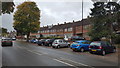
The B4082 in Binley
Housing on the B4082 in Binley, Coventry.
Image: © Peter Mackenzie
Taken: 2 Oct 2018
0.07 miles
2
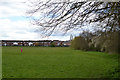
Old field boundary, south side of the playing fields, Binley, Coventry
Blackthorn is coming into flower. The houses are in Bridgeacre Gardens, Binley. The view is from the Sowe Valley footpath.
Image: © Robin Stott
Taken: 23 Apr 2016
0.10 miles
5
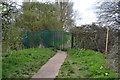
The Sowe Valley footpath passes through a green-painted gate, Binley, Coventry
Strange to have an anti-intruder fence between two public open spaces – unless it's to stop bikes, motor bikes, monkey bikes and horses.
Image: © Robin Stott
Taken: 23 Apr 2016
0.15 miles
6
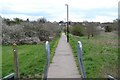
Footpath to Bridgeacre Gardens, Binley, Coventry
The view is from the footbridge over the River Sowe near St Gregory's RC primary school. Blackthorn thickets are flowering white. This view is the reverse of Image
Image: © Robin Stott
Taken: 23 Apr 2016
0.17 miles
7
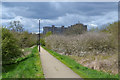
Footpath from Binley across the River Sowe to Harry Rose Road, Stoke, Coventry
Two sorts of order – the straight lines of the path and the lighting; then the way that blackthorn grows – its phyllotaxis – to form a thicket. Access and impenetrability side by side. The route crosses the Sowe Valley footpath. This view is the reverse of Image
Image: © Robin Stott
Taken: 23 Apr 2016
0.17 miles
8
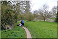
Couple with a dog on the Sowe Valley footpath, Binley, Coventry
The view is roughly north from the footpath east of the footbridge over the River Sowe near St Gregory's RC primary school. The river is to the left.
Image: © Robin Stott
Taken: 23 Apr 2016
0.17 miles
9
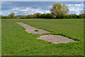
Concrete base of play equipment, playing fields, Binley, Coventry
This was almost certainly the base of a children's slide, of moderate height. There would be metal steps with handrails up to a platform, from which the chute sloped down, becoming level with the ground and finishing with an extended run-out without sides. It could double as a seat or a stage. A child who fell off would likely land on grass. This piece will have been deemed unsafe or in disrepair. Modern equipment has more safety features, opportunities for inappropriate use have been designed out, and the surrounding surface could be expensive coloured rubber crumb. The distant vehicle, left, is at the roundabout on Clifford Bridge Road just south of Sowe Bridge. Behind the hedge, centre and right, is a large allotment site off Bridgeacre Gardens.
Image: © Robin Stott
Taken: 23 Apr 2016
0.18 miles
10
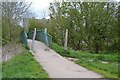
Footbridge over the River Sowe near St Gregory's primary school, Binley, Coventry
The pair of barriers may be configured to allow people to pass on foot or with a pushchair or in a wheelchair, say, but not bikes, motor bikes and horses. The Sowe Valley footpath crosses the river here from east on the right, to west over the bridge. In the background is Vincent Wyles House in Attoxhall Road, Wyken (or is it Stoke?).
Image: © Robin Stott
Taken: 23 Apr 2016
0.19 miles