
IMAGES TAKEN NEAR TO
Kenilworth Road, LEAMINGTON SPA, CV32 7TW
Introduction
This page details the photographs taken nearby to Kenilworth Road, CV32 7TW by members of the Geograph project.
The Geograph project started in 2005 with the aim of publishing, organising and preserving representative images for every square kilometre of Great Britain, Ireland and the Isle of Man.

There are currently over 7.5m images from over14,400 individuals and you can help contribute to the project by visiting https://www.geograph.org.uk
Image Map
Images are licensed for reuse under creativecommons.org/licenses/by-sa/2.0
Notes
- Clicking on the map will re-center to the selected point.
- The higher the marker number, the further away the image location is from the centre of the postcode.
Image Listing (22 Images Found)
Images are licensed for reuse under creativecommons.org/licenses/by-sa/2.0
Image
Details
Distance
1
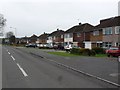
Cubbington
These houses are on the Kenilworth Rd on the northern edge of Cubbington opposite open fields.
Image: © Nigel Mykura
Taken: 19 Feb 2011
0.02 miles
2

Trees near Kenilworth Road, New Cubbington
Image: © Steven Howe
Taken: 7 Dec 2010
0.03 miles
3
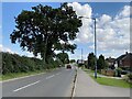
Southeast and uphill on Kenilworth Road, Lillington
A recreational cyclist has to contend with the school run on this busy road.
Image: © Robin Stott
Taken: 16 Sep 2021
0.04 miles
4
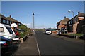
Balmoral Way, New Cubbington
Looking towards open countryside across Kenilworth Road.
Image: © Robin Stott
Taken: 24 Oct 2009
0.05 miles
5
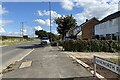
Southeast on Kenilworth Road, Lillington
This is one edge of Leamington: houses look out over the fields. The lighting column is wonky, not the camera.
Image: © Robin Stott
Taken: 16 Sep 2021
0.10 miles
6
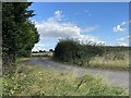
Entry to West Hill Farm from Kenilworth Road
Neither of the two properties served could be described as a farm.
Image: © Robin Stott
Taken: 16 Sep 2021
0.10 miles
7
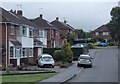
Stirling Avenue, Lillington
A residential street in Lillington, a northern suburb of Leamington Spa. No 55, just off the picture to the left, is the house where I was born.
Image: © Andrew Hill
Taken: 4 Oct 2013
0.10 miles
8
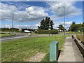
Junction of Leicester Lane, Kenilworth Road and Westhill Road, Lillington
Westhill Road, left, for Kenilworth; Kenilworth Road, right, for Cubbington; ahead for Ryton and Rugby; Leicester once upon a time.
Image: © Robin Stott
Taken: 16 Sep 2021
0.14 miles
9
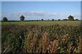
Enlarged field by Kenilworth Road
Field boundaries shown on the OS Explorer map have disappeared. White specks on the skyline are high-rise blocks in the centre of Coventry.
Image: © Robin Stott
Taken: 24 Oct 2009
0.14 miles
10

Northeast from Lillington on Leicester Lane
The wide grass verge gives drivers long sightlines to and from the busy junction behind the camera Image
Image: © Robin Stott
Taken: 16 Sep 2021
0.15 miles