
IMAGES TAKEN NEAR TO
Buckley Road, LEAMINGTON SPA, CV32 7QQ
Introduction
This page details the photographs taken nearby to Buckley Road, CV32 7QQ by members of the Geograph project.
The Geograph project started in 2005 with the aim of publishing, organising and preserving representative images for every square kilometre of Great Britain, Ireland and the Isle of Man.

There are currently over 7.5m images from over14,400 individuals and you can help contribute to the project by visiting https://www.geograph.org.uk
Image Map
Images are licensed for reuse under creativecommons.org/licenses/by-sa/2.0
Notes
- Clicking on the map will re-center to the selected point.
- The higher the marker number, the further away the image location is from the centre of the postcode.
Image Listing (36 Images Found)
Images are licensed for reuse under creativecommons.org/licenses/by-sa/2.0
Image
Details
Distance
1
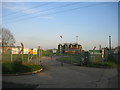
Campion Hills Waterworks
This supplies water to much of Leamington and is fed from Image
Image: © David Stowell
Taken: 27 Apr 2006
0.04 miles
2
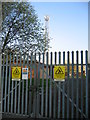
Campion Hill mobile 'phone mast
One of two masts on the Campion Hills. Judging by the number of padlocks on the gate quite a few different network operators share the use of this site!
Image: © David Stowell
Taken: 27 Apr 2006
0.06 miles
3
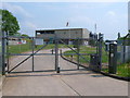
Campion Water Treatment Works
The well guarded water treatment works belong to Severn Trent Water and are located just off Black Lane next to the Campion Hills. The entrance is well provided with CCTV cameras, razor wire and an electric gate opening mechanism.
Image: © Nigel Mykura
Taken: 28 May 2012
0.06 miles
4
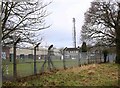
Water treatment works and mobile phone mast
Note the windsock just left of centre. This is to advise wind direction in the event of the accidental release of chlorine gas used as part of the treatment process.
Image: © David P Howard
Taken: 24 Feb 2010
0.07 miles
5
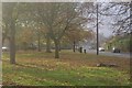
Buckley Road, Lillington
To the south east of Cubbington Road is a large area of post-war local authority housing. In common with many such estates of its era, there is plenty of green open space; here the houses on Buckley Road are set back behind an area of grass and trees.
Image: © Stephen McKay
Taken: 19 Nov 2011
0.08 miles
6
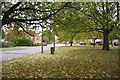
The top end of Buckley Road, Lillington
Seen from a large island in the highway.
Image: © Robin Stott
Taken: 22 Oct 2009
0.08 miles
7
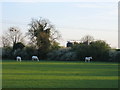
Three white horses
Seen from the drive to Redhouse Farm with the Campion Hill waterworks beyond the hedge.
Image: © David Stowell
Taken: 27 Apr 2006
0.09 miles
8
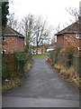
Alleyway between Black Lane and Buckley Road
View North up the alleyway.
Image: © David P Howard
Taken: 24 Feb 2010
0.09 miles
9
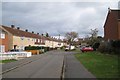
Elton Close, Lillington
Leading to a small greenspace and Denby Close.
Image: © Robin Stott
Taken: 22 Oct 2009
0.10 miles
10

Water treatment works, Campion Hills
The building dates from the late 1960s. The works were planned in 1966 following the setting-up of the South Warwickshire Water Board in 1963. It amalgamated eight smaller water authorities. The works replaced the Campion Terrace water treatment works operated by Leamington Borough since the late 1870s. The view is from the Newbold Comyn Golf Course perimeter track.
Image: © Robin Stott
Taken: 28 Oct 2009
0.10 miles