
IMAGES TAKEN NEAR TO
St. Marks Road, LEAMINGTON SPA, CV32 6DL
Introduction
This page details the photographs taken nearby to St. Marks Road, CV32 6DL by members of the Geograph project.
The Geograph project started in 2005 with the aim of publishing, organising and preserving representative images for every square kilometre of Great Britain, Ireland and the Isle of Man.

There are currently over 7.5m images from over14,400 individuals and you can help contribute to the project by visiting https://www.geograph.org.uk
Image Map
Images are licensed for reuse under creativecommons.org/licenses/by-sa/2.0
Notes
- Clicking on the map will re-center to the selected point.
- The higher the marker number, the further away the image location is from the centre of the postcode.
Image Listing (141 Images Found)
Images are licensed for reuse under creativecommons.org/licenses/by-sa/2.0
Image
Details
Distance
1
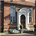
Former St Mark's Vicarage
The main door, facing St Mark's Road.
Image: © Alan Murray-Rust
Taken: 4 Mar 2017
0.02 miles
2
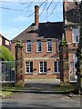
Gateway to the Old Vicarage, St Mark's Road
Part of a set of walls and railings enclosing the Vicarage and neighbouring properties, built 1879 by George Gilbert Scott Jnr. Listed Grade II, the description refers to cast iron railings, but these appear to have been replaced.
Image: © Alan Murray-Rust
Taken: 4 Mar 2017
0.02 miles
3
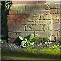
Bench mark, St Mark's Road
See http://www.geograph.org.uk/photo/5302318 for location.
Image: © Alan Murray-Rust
Taken: 4 Mar 2017
0.02 miles
4
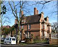
Former St Mark's Vicarage
Built 1879 to the design of architect George Gilbert Scott Jnr, who also designed the church, in Queen Anne revival style. Converted to apartments in around 1970. Listed Grade II.
Image: © Alan Murray-Rust
Taken: 4 Mar 2017
0.02 miles
5
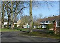
Modern housing, St Mark's Road
A mid 20th century development of largish detached houses, filling an undeveloped plot.
There is a bench mark http://www.geograph.org.uk/photo/5302320 on the brick pier at the right hand edge.
Image: © Alan Murray-Rust
Taken: 4 Mar 2017
0.04 miles
6
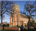
St Mark's Church, Rugby Road, Leamington Spa
View from Rugby Road.
Image: © David P Howard
Taken: 24 Jan 2010
0.05 miles
7
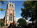
St.Mark's Church, Rugby Road, Milverton
Photo taken on a visit during Heritage Open Days 2010.
In 1875 an Act of Parliament created a new parish by dividing the original Milverton parish into two. This parish was then known as New Milverton. The money for building the church came from the legacy of Lady Frances Wheler, the sister of the parish's first vicar Charles Carus-Wilson. The land was given by the Heber-Percy family, the Dukes of Northumberland.
The church was designed by George Gilbert Scott junior, is his only surviving church, and is thought to be his best surviving work. There is a magnificent set of stained glass windows, some by the famous stained glass artist William Kempe.
Image: © John Brightley
Taken: 12 Sep 2010
0.06 miles
8
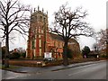
Leamington Spa-Saint Mark's Church
Church of England, dating from 1879 in New Milverton.
Image: © Ian Rob
Taken: 22 Nov 2014
0.06 miles
9
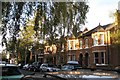
Gaveston Road, Leamington Spa
These houses in the characteristic large pale orange Leamington brick, together with those in adjoining Greatheed Road, were built by Samuel and Arthur Bird between 1903 and 1911.
Gaveston refers to Piers Gaveston http://en.wikipedia.org/wiki/Piers_Gaveston,_1st_Earl_of_Cornwall , favourite, possibly lover, of King Edward II. In 1312 he was murdered by his enemies on nearby Blacklow Hill Image where there is a commemorative cross, not yet photographed. A number of other streetnames in Leamington and Warwick refer to people and places associated with Gaveston's life and death.
Image: © Robin Stott
Taken: 12 Oct 2009
0.07 miles
10
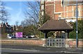
Lych gate and churchyard wall, St Mark's Church
The wall dates from the construction of the church in 1879, the lychgate being a 20th century addition in memory of Lieut. Gen. Sir John Lindesay Keir K.G.B. churchwarden of the church. Listed Grade II.
Image: © Alan Murray-Rust
Taken: 4 Mar 2017
0.07 miles