
IMAGES TAKEN NEAR TO
Hussar Court, COVENTRY, CV3 1NS
Introduction
This page details the photographs taken nearby to Hussar Court, CV3 1NS by members of the Geograph project.
The Geograph project started in 2005 with the aim of publishing, organising and preserving representative images for every square kilometre of Great Britain, Ireland and the Isle of Man.

There are currently over 7.5m images from over14,400 individuals and you can help contribute to the project by visiting https://www.geograph.org.uk
Image Map
Images are licensed for reuse under creativecommons.org/licenses/by-sa/2.0
Notes
- Clicking on the map will re-center to the selected point.
- The higher the marker number, the further away the image location is from the centre of the postcode.
Image Listing (69 Images Found)
Images are licensed for reuse under creativecommons.org/licenses/by-sa/2.0
Image
Details
Distance
1
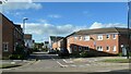
Hussar Court, Lower Stoke, Coventry
Part of a newish development on the site of the Humber and Hillman car factories.
Image: © Christine Johnstone
Taken: 24 Sep 2021
0.02 miles
2

Houses on Humber Road, Lower Stoke, Coventry
Newish development on the site of the Humber & Hillman car factories.
Image: © Christine Johnstone
Taken: 24 Sep 2021
0.04 miles
3
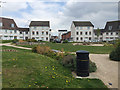
Central open space, Gibraltar Close, Lower Stoke, Coventry
Housing on the sites of the Humber and Hillman car factories.
Image: © Robin Stott
Taken: 13 Apr 2019
0.04 miles
4
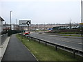
Coventry-Humber Road
Looking towards Lower Stoke and the flattened remains of the Peugeot Engine Plant.
Image: © Ian Rob
Taken: 25 Jan 2010
0.05 miles
5

Bend on Humber Road, Lower Stoke, Coventry
The road has been remodelled through the development on the sites of the Humber and Hillman car factories.
Image: © Robin Stott
Taken: 13 Apr 2019
0.05 miles
6
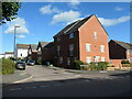
Grenadier Drive, Lower Stoke, Coventry
Newish housing built on the site of the Hillman car factory.
Image: © Christine Johnstone
Taken: 24 Sep 2021
0.06 miles
7
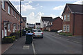
Gibraltar Close, Lower Stoke, Coventry
Housing on the sites of the Humber and Hillman car factories.
Image: © Robin Stott
Taken: 13 Apr 2019
0.08 miles
8
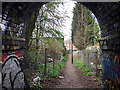
Footpath to Humber Road, Lower Stoke, Coventry
The view is from the subway through the embankment that once carried the Coventry Loop Line. The reverse view is Image
Image: © Robin Stott
Taken: 13 Apr 2019
0.08 miles
9
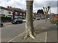
Humber Road with pollarded plane trees, Lower Stoke, Coventry
Image: © Robin Stott
Taken: 13 Apr 2019
0.08 miles
10
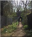
Footpath approaching a subway through a former railway embankment, Coventry
The embankment carried the Coventry Loop Line: see Image
Image: © Robin Stott
Taken: 13 Apr 2019
0.08 miles