IMAGES TAKEN NEAR TO
Gowling Close, LEAMINGTON SPA, CV31 1WP
Introduction
This page details the photographs taken nearby to Gowling Close, CV31 1WP by members of the Geograph project.
The Geograph project started in 2005 with the aim of publishing, organising and preserving representative images for every square kilometre of Great Britain, Ireland and the Isle of Man.

There are currently over 7.5m images from over14,400 individuals and you can help contribute to the project by visiting https://www.geograph.org.uk
Image Map (Loading...)


Getting Data...Please wait
Leaflet Map data © OpenStreetMap
Images are licensed for reuse under creativecommons.org/licenses/by-sa/2.0
Notes
- Clicking on the map will re-center to the selected point.
- The higher the marker number, the further away the image location is from the centre of the postcode.
Image Listing (29 Images Found)
Images are licensed for reuse under creativecommons.org/licenses/by-sa/2.0
Image
Details
Distance
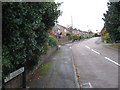
1
Looking northwest along Offchurch Lane, Radford Semele
Image: © Andy F
Taken: 12 Nov 2009
0.11 miles
3
Abutments of former Leamington - Rugby Line
These walls beside the Radford Semele - Offchurch road are the remains of the skew bridge carrying the former LNWR line from Leamington Spa to Rugby via Marton Junction.
Image: © David Stowell
Taken: 19 Mar 2009
0.15 miles
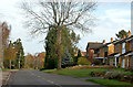
4
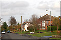
Houses on Southam Road A425
East of Radford Semele.
Image: © Robin Stott
Taken: 20 Dec 2009
0.19 miles
5
![Radford Semele houses [6]](https://s3.geograph.org.uk/geophotos/06/27/29/6272975_88202b31_120x120.jpg)
Radford Semele houses [6]
Number 1 Lewis Road is an early 19th century brick built house. Listed, grade II, with details at: https://historicengland.org.uk/listing/the-list/list-entry/1035193
Radford Semele is a village on the A425 road between Royal Leamington Spa and Southam. The village is named after a family from Saint-Pierre-de-Semilly in Normandy, lords of the manor circa 1120.
Image: © Michael Dibb
Taken: 31 Jul 2019
0.20 miles
6
![Radford Semele buildings [3]](https://s2.geograph.org.uk/geophotos/06/27/42/6274294_e2dc010d_120x120.jpg)
Radford Semele buildings [3]
This fine wood built bus shelter is much more appropriate to its surrounds than the usual metal, glass and plastic versions.
Radford Semele is a village on the A425 road between Royal Leamington Spa and Southam. The village is named after a family from Saint-Pierre-de-Semilly in Normandy, lords of the manor circa 1120.
Image: © Michael Dibb
Taken: 31 Jul 2019
0.20 miles
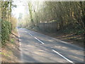
7
Looking north along Lewis Road, Radford Semele
Image: © Andy F
Taken: 12 Nov 2009
0.20 miles
8
![Radford Semele houses [8]](https://s0.geograph.org.uk/geophotos/06/27/30/6273056_59c7b5f7_120x120.jpg)
Radford Semele houses [8]
The Old Bakery with this fine bay window in Lewis Road is next door to The Old Dairy Image
Radford Semele is a village on the A425 road between Royal Leamington Spa and Southam. The village is named after a family from Saint-Pierre-de-Semilly in Normandy, lords of the manor circa 1120.
Image: © Michael Dibb
Taken: 31 Jul 2019
0.21 miles
9
![Radford Semele houses [7]](https://s2.geograph.org.uk/geophotos/06/27/30/6273054_fde8f5d2_120x120.jpg)
Radford Semele houses [7]
The Old Dairy is early 19th century and, as the name implies was once a dairy. Listed, grade II, with details at: https://historicengland.org.uk/listing/the-list/list-entry/1035194 The Old Dairy is next door to The Old Bakery Image
Radford Semele is a village on the A425 road between Royal Leamington Spa and Southam. The village is named after a family from Saint-Pierre-de-Semilly in Normandy, lords of the manor circa 1120.
Image: © Michael Dibb
Taken: 31 Jul 2019
0.21 miles
10

Abandoned Triumph Herald
Triumph Herald abandoned among trees, Radford Semele.
Image: © A J Paxton
Taken: 25 Jul 2020
0.21 miles