
IMAGES TAKEN NEAR TO
Hall Fields, LEAMINGTON SPA, CV31 1TS
Introduction
This page details the photographs taken nearby to Hall Fields, CV31 1TS by members of the Geograph project.
The Geograph project started in 2005 with the aim of publishing, organising and preserving representative images for every square kilometre of Great Britain, Ireland and the Isle of Man.

There are currently over 7.5m images from over14,400 individuals and you can help contribute to the project by visiting https://www.geograph.org.uk
Image Map
Images are licensed for reuse under creativecommons.org/licenses/by-sa/2.0
Notes
- Clicking on the map will re-center to the selected point.
- The higher the marker number, the further away the image location is from the centre of the postcode.
Image Listing (71 Images Found)
Images are licensed for reuse under creativecommons.org/licenses/by-sa/2.0
Image
Details
Distance
1
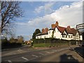
Radford Semele
The junction of the main Leamington Spa to Southam road and the road to Offchurch.
Image: © David Stowell
Taken: 14 Apr 2005
0.05 miles
2
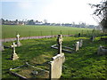
Radford Semele from St Nicholas' churchyard
3
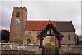
Radford Semele Church
Dedicated to St. Nicholas
Image: © Geoff Pick
Taken: 7 Mar 2005
0.05 miles
4
![Radford Semele houses [13]](https://s1.geograph.org.uk/geophotos/06/27/42/6274289_395f2451_120x120.jpg)
Radford Semele houses [13]
The Manor Cottage is 18th century brick built and thatched. Listed, grade II, with details at: https://historicengland.org.uk/listing/the-list/list-entry/1364970
Radford Semele is a village on the A425 road between Royal Leamington Spa and Southam. The village is named after a family from Saint-Pierre-de-Semilly in Normandy, lords of the manor circa 1120.
Image: © Michael Dibb
Taken: 31 Jul 2019
0.05 miles
5
![Radford Semele buildings [2]](https://s1.geograph.org.uk/geophotos/06/27/42/6274293_52a0d651_120x120.jpg)
Radford Semele buildings [2]
St Andrews House is home to a firm of surveyors.
Radford Semele is a village on the A425 road between Royal Leamington Spa and Southam. The village is named after a family from Saint-Pierre-de-Semilly in Normandy, lords of the manor circa 1120.
Image: © Michael Dibb
Taken: 31 Jul 2019
0.05 miles
6
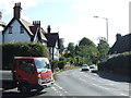
Southam Road, Radford Semele
The A425 heading east.
Image: © JThomas
Taken: 29 Sep 2012
0.06 miles
7
![Radford Semele houses [14]](https://s3.geograph.org.uk/geophotos/06/27/42/6274291_909403e1_120x120.jpg)
Radford Semele houses [14]
Numbers 64 and 66 Southam Road are a pair of 17th century timber framed and thatched cottages that have been later encased in brick. Listed, grade II, with details at: https://historicengland.org.uk/listing/the-list/list-entry/1035138
Radford Semele is a village on the A425 road between Royal Leamington Spa and Southam. The village is named after a family from Saint-Pierre-de-Semilly in Normandy, lords of the manor circa 1120.
Image: © Michael Dibb
Taken: 31 Jul 2019
0.06 miles
8
![Radford Semele houses [9]](https://s0.geograph.org.uk/geophotos/06/27/30/6273092_e51dafb3_120x120.jpg)
Radford Semele houses [9]
This small complex of co-joined buildings has 3 dwellings therein. The Gable House, The Knowle and The Manor House. There was originally a hunting lodge on the site but the buildings visible now date from the 1820s.
Radford Semele is a village on the A425 road between Royal Leamington Spa and Southam. The village is named after a family from Saint-Pierre-de-Semilly in Normandy, lords of the manor circa 1120.
Image: © Michael Dibb
Taken: 31 Jul 2019
0.07 miles
9
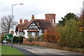
House and folly tower on Southam Road, Radford Semele
Image: © Andy F
Taken: 12 Nov 2009
0.07 miles
10
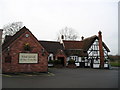
The White Lion Pub, Radford Semele, Leamington Spa
Southam Road, Leamington Spa, CV31 1TE close the Grand Union Canal
Image: © canalandriversidepubs co uk
Taken: 5 Feb 2010
0.07 miles