
IMAGES TAKEN NEAR TO
Marbled Close, LEAMINGTON SPA, CV31 1AY
Introduction
This page details the photographs taken nearby to Marbled Close, CV31 1AY by members of the Geograph project.
The Geograph project started in 2005 with the aim of publishing, organising and preserving representative images for every square kilometre of Great Britain, Ireland and the Isle of Man.

There are currently over 7.5m images from over14,400 individuals and you can help contribute to the project by visiting https://www.geograph.org.uk
Image Map
Images are licensed for reuse under creativecommons.org/licenses/by-sa/2.0
Notes
- Clicking on the map will re-center to the selected point.
- The higher the marker number, the further away the image location is from the centre of the postcode.
Image Listing (28 Images Found)
Images are licensed for reuse under creativecommons.org/licenses/by-sa/2.0
Image
Details
Distance
1
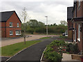
The view from the eastern end of Admiral Way, Upper Sydenham, south Leamington
An estate only half complete. From here and from Marbled Close there is a view over the Whitnash Brook local nature reserve and open country south of Radford Semele – for how long, one wonders.
Image: © Robin Stott
Taken: 28 Apr 2017
0.04 miles
2
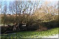
Neglected willow pollards, east bank of Whitnash Brook
Recent housing on the former Green Farm can be glimpsed through the trees.
Image: © Robin Stott
Taken: 20 Dec 2009
0.07 miles
3
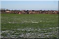
Recent housing, Whitnash and Sydenham
Seen from higher ground east of Radford Barn.
Image: © Robin Stott
Taken: 20 Dec 2009
0.07 miles
4
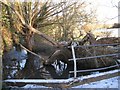
Bridge over Whitnash Brook
Old pollarded willows sprawl over the brook or collapse for want of management.
Image: © Robin Stott
Taken: 20 Dec 2009
0.07 miles
6

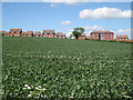
New estate will extend up to the bridleway, Upper Sydenham, Whitnash
Ahead, the bridleway joins Church Lane, Whitnash. Behind the camera it heads for Radford Barn, or there is a footpath north beside the Whitnash Brook through the local nature reserve.
Image: © Robin Stott
Taken: 28 Apr 2017
0.08 miles
7
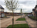
New estate in Upper Sydenham, Whitnash
Looking down Admiral Way towards the Whitnash Brook valley. All the roads on this estate are named after butterflies. The developer is A.C.Lloyd, a local firm. This was a greenfield site, part of Green Farm, Whitnash: see Image from 2009, and Image from 2010.
Image: © Robin Stott
Taken: 28 Apr 2017
0.08 miles
8
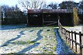
Old barn and recent paddock fence near Radford Barn
Image: © Robin Stott
Taken: 20 Dec 2009
0.10 miles
10

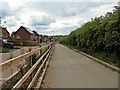
Paddocks east of Whitnash Brook
The track heads for Whitnash from the direction of Radford Barn. Recent housing on the former Green Farm occupies the skyline.
Image: © Robin Stott
Taken: 20 Dec 2009
0.13 miles