
IMAGES TAKEN NEAR TO
Attoxhall Road, COVENTRY, CV2 5NG
Introduction
This page details the photographs taken nearby to Attoxhall Road, CV2 5NG by members of the Geograph project.
The Geograph project started in 2005 with the aim of publishing, organising and preserving representative images for every square kilometre of Great Britain, Ireland and the Isle of Man.

There are currently over 7.5m images from over14,400 individuals and you can help contribute to the project by visiting https://www.geograph.org.uk
Image Map
Images are licensed for reuse under creativecommons.org/licenses/by-sa/2.0
Notes
- Clicking on the map will re-center to the selected point.
- The higher the marker number, the further away the image location is from the centre of the postcode.
Image Listing (15 Images Found)
Images are licensed for reuse under creativecommons.org/licenses/by-sa/2.0
Image
Details
Distance
1
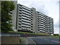
Coventry Towerblocks
At the junction of Attoxhall Road and Harry Rose Road.
Image: © Ian Rob
Taken: 24 Jun 2011
0.02 miles
2

Flats in Wyken across the Sowe valley, Coventry
The blocks of flats half hidden by the trees are William Malcolm House, right, and Vincent Wyles House, left, on Attoxhall Road, Wyken. Things to note: part of an extensive stand of reedmace ('bulrush'), left, a raised manhole that says 'sewer', two-storey houses nestling at the foot of the tower blocks, a rugby ground on the floodplain across the river.
Image: © Robin Stott
Taken: 23 Apr 2016
0.03 miles
3

View north to Stoke from a footbridge over the River Sowe, Coventry
The footbridge is near St Gregory's RC Primary School. Caludon Castle School is on the right.
Image: © Robin Stott
Taken: 23 Apr 2016
0.14 miles
4
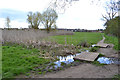
Wet ground with reedmace on the playing fields, Binley, Coventry
Reedmace, wrongly called bulrush, is a species of Typha. Duckboards take the Sowe Valley footpath over the wet and sometimes muddy ground. The river is immediately to the right.
Image: © Robin Stott
Taken: 23 Apr 2016
0.20 miles
5
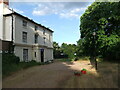
Stoke House, Wyken
Stoke House was built over 200 years ago and occupies a secluded site, surrounded by mature trees. It was the birthplace of Colonel William Fitzthomas Wyley, a chemist, who became the Lord Mayor of Coventry in 1911; he bought the Charterhouse, made it his home and bequeathed it to the city. After use by a barrage balloon unit during the Second World War, Stoke House became a children's home, and later offices for social/children's services. A modern secure unit for young people was built in the grounds and was demolished in 2013. Property guardians were living in the house at that time, and there was a planning application to convert it into a care home. Behind the house was a cobbled courtyard with a stable block. https://www.coventrysociety.org.uk/news/article/planning-permission-sought-for-conversion-of-stoke-house.html
Image: © A J Paxton
Taken: 24 Jul 2013
0.20 miles
6

Outfall to the River Sowe and a footbridge over it, near Stoke, Coventry
Image: © Robin Stott
Taken: 23 Apr 2016
0.20 miles
7
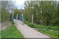
Footbridge over the River Sowe near St Gregory's primary school, Binley, Coventry
The pair of barriers may be configured to allow people to pass on foot or with a pushchair or in a wheelchair, say, but not bikes, motor bikes and horses. The Sowe Valley footpath crosses the river here from east on the right, to west over the bridge. In the background is Vincent Wyles House in Attoxhall Road, Wyken (or is it Stoke?).
Image: © Robin Stott
Taken: 23 Apr 2016
0.21 miles
8
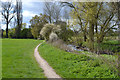
Sowe Valley footpath at the edge of playing fields, Binley, Coventry
The blocks of flats half hidden by the trees are William Malcolm House and Vincent Wyles House on Attoxhall Road, Stoke.
Image: © Robin Stott
Taken: 23 Apr 2016
0.21 miles
9
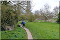
Couple with a dog on the Sowe Valley footpath, Binley, Coventry
The view is roughly north from the footpath east of the footbridge over the River Sowe near St Gregory's RC primary school. The river is to the left.
Image: © Robin Stott
Taken: 23 Apr 2016
0.22 miles
10
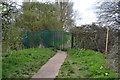
The Sowe Valley footpath passes through a green-painted gate, Binley, Coventry
Strange to have an anti-intruder fence between two public open spaces – unless it's to stop bikes, motor bikes, monkey bikes and horses.
Image: © Robin Stott
Taken: 23 Apr 2016
0.22 miles