
IMAGES TAKEN NEAR TO
Farren Road, COVENTRY, CV2 5EN
Introduction
This page details the photographs taken nearby to Farren Road, CV2 5EN by members of the Geograph project.
The Geograph project started in 2005 with the aim of publishing, organising and preserving representative images for every square kilometre of Great Britain, Ireland and the Isle of Man.

There are currently over 7.5m images from over14,400 individuals and you can help contribute to the project by visiting https://www.geograph.org.uk
Image Map
Images are licensed for reuse under creativecommons.org/licenses/by-sa/2.0
Notes
- Clicking on the map will re-center to the selected point.
- The higher the marker number, the further away the image location is from the centre of the postcode.
Image Listing (34 Images Found)
Images are licensed for reuse under creativecommons.org/licenses/by-sa/2.0
Image
Details
Distance
1
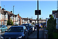
South on Arch Road, Wyken, Coventry
Twenty minutes past three – parents are collecting children from school.
Image: © Robin Stott
Taken: 1 Oct 2015
0.07 miles
2
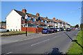
Terraced houses, northwest side of Ansty Road, Wyken, Coventry
The near houses appear to be of semi-detached pattern butted up to form a short terrace. Below the small gable is a plaque bearing the date 1909.
Image: © Robin Stott
Taken: 1 Oct 2015
0.09 miles
3
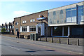
Wyken Working Men's Club, Ansty Road, Wyken, Coventry
It's affiliated to the CIU: the Working Men's Club and Institute Union. https://en.wikipedia.org/wiki/Working_Men%27s_Club_and_Institute_Union
Image: © Robin Stott
Taken: 1 Oct 2015
0.10 miles
4
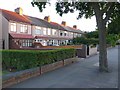
Terraced Houses in Wyken
These houses are on the south side of the Ansty Rd between Hocking Rd and the Hipswell Highway.
Image: © Nigel Mykura
Taken: 18 Aug 2010
0.11 miles
5
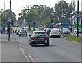
A4600 Ansty Road in Wyken
Heading towards Coventry city centre.
Image: © Mat Fascione
Taken: 11 Sep 2014
0.14 miles
6
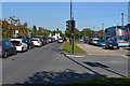
Northeast on Ansty Road, A4600, Wyken, Coventry
Traffic on the left is queueing to negotiate roadworks at the junction with Clifford Bridge Road. Traffic on the right is queueing at the lights controlling the junction with Wyken Croft.
Image: © Robin Stott
Taken: 1 Oct 2015
0.14 miles
7
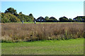
Sown wildflowers seeding, Caludon Castle Park, Wyken, Coventry
The houses are in Belgrave Road Image The trees on the left are on the line of the earlier moat mentioned in John Brightley's Image
Image: © Robin Stott
Taken: 1 Oct 2015
0.14 miles
8
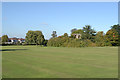
Remains of Caludon Castle ? the context: Caludon Castle Park, Wyken, Coventry
Image: © Robin Stott
Taken: 1 Oct 2015
0.16 miles
9
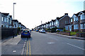
Southeast on Farren Road, Wyken, Coventry
Viewed from the north entrance to Caludon Castle Park.
Image: © Robin Stott
Taken: 1 Oct 2015
0.16 miles
10
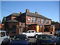
Coventry Oak Flaming Grill, Ansty Road/Hipswell Highway, Wyken, Coventry
Themed eaterie, seen from a bus.
Image: © Robin Stott
Taken: 22 Sep 2013
0.16 miles