
IMAGES TAKEN NEAR TO
Westmorland Road, COVENTRY, CV2 5BU
Introduction
This page details the photographs taken nearby to Westmorland Road, CV2 5BU by members of the Geograph project.
The Geograph project started in 2005 with the aim of publishing, organising and preserving representative images for every square kilometre of Great Britain, Ireland and the Isle of Man.

There are currently over 7.5m images from over14,400 individuals and you can help contribute to the project by visiting https://www.geograph.org.uk
Image Map
Images are licensed for reuse under creativecommons.org/licenses/by-sa/2.0
Notes
- Clicking on the map will re-center to the selected point.
- The higher the marker number, the further away the image location is from the centre of the postcode.
Image Listing (48 Images Found)
Images are licensed for reuse under creativecommons.org/licenses/by-sa/2.0
Image
Details
Distance
1
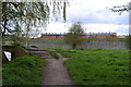
The Sowe Valley footpath nears a footbridge in sight of Caludon Castle School, Coventry
The path criss-crosses the river.
Image: © Robin Stott
Taken: 23 Apr 2016
0.09 miles
2
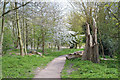
A Lombardy Poplar has split and fallen by the Sowe Valley footpath, Coventry
The path has been cleared by chainsaw and muscle. A cherry tree has come elegantly into flower.
Image: © Robin Stott
Taken: 23 Apr 2016
0.10 miles
3
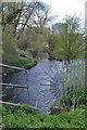
River Sowe, looking downstream past Caludon Castle School, Coventry
The blocks of flats in the distance are William Malcolm House and Vincent Wyles House on Attoxhall Road, Wyken CV2. The view is from the Sowe Valley footpath.
Image: © Robin Stott
Taken: 23 Apr 2016
0.11 miles
4
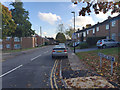
South on Westmorland Road, Walsgrave, Coventry
It's a turning off Belgrave Road.
Image: © Robin Stott
Taken: 28 Oct 2015
0.11 miles
5
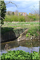
Outfall to the River Sowe from Wyken, Coventry
Probably surface water from nearby development. The blocks of flats are off Westmorland Road. Behind the bushes, above centre, are the sports areas for Caludon Castle School Image
Image: © Robin Stott
Taken: 23 Apr 2016
0.11 miles
6
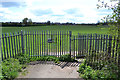
Gates into playing fields, Sowe Valley, Binley, Coventry
In the distance, the Binley estates. The hedged land on the left is a large allotments site off Clifford Bridge Road. The Sowe Valley footpath continues to the right. The view is from a footbridge over the river.
Image: © Robin Stott
Taken: 23 Apr 2016
0.11 miles
7
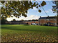
Grassy open space south of Keswick Walk houses, Walsgrave, Coventry
Image: © Robin Stott
Taken: 28 Oct 2015
0.11 miles
8
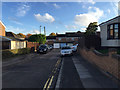
South on St Just's Road, Walsgrave, Coventry
It's a cul-de-sac off Belgrave Road.
Image: © Robin Stott
Taken: 28 Oct 2015
0.12 miles
9
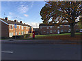
Houses, open space and postbox CV2 412, Belgrave Road, Walsgrave, Coventry
The houses on the left are in the group numbered 192-210 Belgrave Road.
Image: © Robin Stott
Taken: 28 Oct 2015
0.12 miles
10
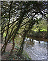
Blackthorn thicket by the River Sowe near Westmorland Road, Coventry
A continuing exploration of the valley finds blackthorn thickets everywhere. This one was just coming into flower. There is a large flat grassy open space on the other side of the river.
Image: © Robin Stott
Taken: 23 Apr 2016
0.13 miles