
IMAGES TAKEN NEAR TO
Richmond Street, COVENTRY, CV2 4JA
Introduction
This page details the photographs taken nearby to Richmond Street, CV2 4JA by members of the Geograph project.
The Geograph project started in 2005 with the aim of publishing, organising and preserving representative images for every square kilometre of Great Britain, Ireland and the Isle of Man.

There are currently over 7.5m images from over14,400 individuals and you can help contribute to the project by visiting https://www.geograph.org.uk
Image Map
Images are licensed for reuse under creativecommons.org/licenses/by-sa/2.0
Notes
- Clicking on the map will re-center to the selected point.
- The higher the marker number, the further away the image location is from the centre of the postcode.
Image Listing (67 Images Found)
Images are licensed for reuse under creativecommons.org/licenses/by-sa/2.0
Image
Details
Distance
2
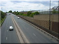
Stoke-The A444
Looking southbound from the Caludon Road bridge. The road follows the course of the dismantled railway as far as the Binley Road island.
Image: © Ian Rob
Taken: 24 Jun 2011
0.08 miles
3
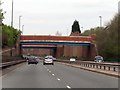
Jimmy Hill Way runs under Caludon Road
Image: © Steve Daniels
Taken: 23 Mar 2019
0.09 miles
5
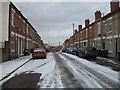
Villiers Street, Middle Stoke, Coventry
Image: © Alex McGregor
Taken: 2 Dec 2010
0.10 miles
6
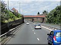
Caludon Road Crossing the A444, Coventry
Bridge taking Caludon Road over the A444, north of Coventry city centre.
Image: © David Dixon
Taken: 5 Aug 2013
0.10 miles
7
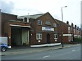
Stoke-Swan Lane
An factory amidst the terraced houses.
Image: © Ian Rob
Taken: 24 Jun 2011
0.11 miles
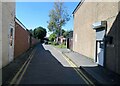
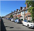
10
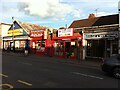
Shop fronts on Walsgrave Road, Ball Hill, Coventry
Despite being choked with road traffic, Ball Hill in Stoke is a lively multicultural neighbourhood with many locally-owned shops. There have been some changes in the ten years since the last Geograph image of this location was submitted. https://www.geograph.org.uk/photo/2477928 The pound shop has become the Easy Shop & Butcher selling halal meat, although the pound shop strapline survives on the fascia board. The Flames Grill has hardly changed, but the Dental Lab, which offered to make and repair dentures, is now the modestly-named Excellent Food Store, selling African & Caribbean food. The Ball Hill Shoe & Key Centre is now Keys Cut & Shoe Repairs, so little has changed there.
Image: © A J Paxton
Taken: 11 Jun 2021
0.13 miles