
IMAGES TAKEN NEAR TO
Clara Street, COVENTRY, CV2 4ET
Introduction
This page details the photographs taken nearby to Clara Street, CV2 4ET by members of the Geograph project.
The Geograph project started in 2005 with the aim of publishing, organising and preserving representative images for every square kilometre of Great Britain, Ireland and the Isle of Man.

There are currently over 7.5m images from over14,400 individuals and you can help contribute to the project by visiting https://www.geograph.org.uk
Image Map
Images are licensed for reuse under creativecommons.org/licenses/by-sa/2.0
Notes
- Clicking on the map will re-center to the selected point.
- The higher the marker number, the further away the image location is from the centre of the postcode.
Image Listing (43 Images Found)
Images are licensed for reuse under creativecommons.org/licenses/by-sa/2.0
Image
Details
Distance
1
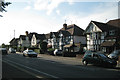
Houses, west end of Binley Road, Coventry CV3
Image: © Robin Stott
Taken: 9 Aug 2012
0.03 miles
2
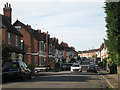
South end of Marlborough Road, Coventry CV2
Image: © Robin Stott
Taken: 9 Aug 2012
0.06 miles
3
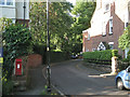
West end of South Avenue, Stoke Park, Coventry CV2
Postbox CV2 71. "The area known as Stoke Park was developed from the 1860s and is completely surrounded by a curving sandstone wall…some sources suggest that this is the site of the old racecourse."
David McGrory. The Illustrated History of Coventry's Suburbs. Derby: Breedon Books, 2003. ISBN 1 85983 343 8
Image: © Robin Stott
Taken: 9 Aug 2012
0.07 miles
4
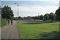
Gosford Park looking south, Coventry CV3
Image: © Robin Stott
Taken: 9 Aug 2012
0.08 miles
5
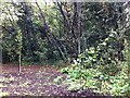
Town Gardens, Gosford Green, Coventry
Coventry was surrounded by a large number of town gardens kept by townspeople in the 18th and 19th centuries, most of which have since been built over (Park Gardens in Cheylesmore are a rare survival). https://www.ourwarwickshire.org.uk/content/article/early-allotments-town-gardens-coventry The town gardens at Gosford Green lost part of their land to a railway and what remains is now a sliver of overgrown land between Kingsway, a suburban street, and the A444 Jimmy Hill Way, built along the route of the former railway. A local voluntary group is clearing the site, rescuing surviving Victorian fruit trees and planting new ones. Visited during a heritage weekend in 2019.
Image: © A J Paxton
Taken: 22 Sep 2019
0.08 miles
6
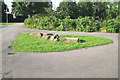
Path junction, Gosford Park, Coventry CV3
The protruding stones must have some archaeological significance. Beyond the bracken is a dell in which other masonry is exposed.
Image: © Robin Stott
Taken: 9 Aug 2012
0.09 miles
7
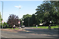
Stoke Green, Coventry CV3
At its junction with Binley Road. The play area in Stoke Park is behind the tree on the left Image
Image: © Robin Stott
Taken: 9 Aug 2012
0.09 miles
8
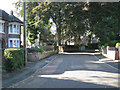
West Avenue, Stoke Park, Coventry CV2
"The area known as Stoke Park was developed from the 1860s and is completely surrounded by a curving sandstone wall…some sources suggest that this is the site of the old racecourse."
David McGrory. The Illustrated History of Coventry's Suburbs. Derby: Breedon Books, 2003. ISBN 1 85983 343 8
Image: © Robin Stott
Taken: 9 Aug 2012
0.09 miles
9
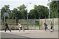
Basketball on Gosford Park MUGA, Coventry CV3
MUGA stands for Multi-use games area.
Image: © Robin Stott
Taken: 9 Aug 2012
0.11 miles
10
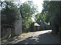
South Avenue, Stoke Park, Coventry CV2
"The area known as Stoke Park was developed from the 1860s and is completely surrounded by a curving sandstone wall…some sources suggest that this is the site of the old racecourse."
David McGrory. The Illustrated History of Coventry's Suburbs. Derby: Breedon Books, 2003. ISBN 1 85983 343 8
Image: © Robin Stott
Taken: 9 Aug 2012
0.11 miles