
IMAGES TAKEN NEAR TO
North Avenue, COVENTRY, CV2 4DH
Introduction
This page details the photographs taken nearby to North Avenue, CV2 4DH by members of the Geograph project.
The Geograph project started in 2005 with the aim of publishing, organising and preserving representative images for every square kilometre of Great Britain, Ireland and the Isle of Man.

There are currently over 7.5m images from over14,400 individuals and you can help contribute to the project by visiting https://www.geograph.org.uk
Image Map
Images are licensed for reuse under creativecommons.org/licenses/by-sa/2.0
Notes
- Clicking on the map will re-center to the selected point.
- The higher the marker number, the further away the image location is from the centre of the postcode.
Image Listing (39 Images Found)
Images are licensed for reuse under creativecommons.org/licenses/by-sa/2.0
Image
Details
Distance
1
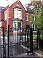
Elm Bank, Stoke Park, Coventry
Elm Bank was for more than forty years the home of Siegfried Bettmann, founder and managing director of the Triumph motorcycle company. Born into a Jewish family in Nuremberg in 1863, Bettmann settled in Coventry in 1885 and began selling bicycles the following year. He founded Triumph with a fellow-German, Moritz Schulte; the company began making bicycles in Coventry in 1888 and diversified into motorcycles in 1902. Bettmann was elected mayor of Coventry in 1913 but was forced to resign the following year amid anti-German hysteria at the outbreak of the first world war. https://www.jewishlivesproject.com/profiles/siegfried-bettmann https://en.wikipedia.org/wiki/Siegfried_Bettmann
A blue plaque remembering Bettmann was placed on the house in 2015; https://www.coventrysociety.org.uk/news/article/bettmanns-home-gets-blue-plaque.html it can be seen in the centre of the photo. The house and outbuildings have since been divided into fourteen luxury flats and bungalows. https://www.coventrytelegraph.net/news/coventry-news/former-home-triumph-cycles-founder-19601495 They are situated in Stoke Park, a walled estate of large houses built in the later 19th century.
Image: © A J Paxton
Taken: 11 Jun 2021
0.01 miles
2
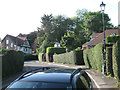
East Avenue, Stoke Park, Coventry CV2
"The area known as Stoke Park was developed from the 1860s and is completely surrounded by a curving sandstone wall…some sources suggest that this is the site of the old racecourse."
David McGrory. The Illustrated History of Coventry's Suburbs. Derby: Breedon Books, 2003. ISBN 1 85983 343 8
Image: © Robin Stott
Taken: 9 Aug 2012
0.10 miles
3
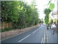
Looking north up Bray's Lane, Coventry CV2
The wall on the left, perhaps reduced in height, is referred to thus: "The area known as Stoke Park was developed from the 1860s and is completely surrounded by a curving sandstone wall…some sources suggest that this is the site of the old racecourse."
David McGrory. The Illustrated History of Coventry's Suburbs. Derby: Breedon Books, 2003. ISBN 1 85983 343 8
Image: © Robin Stott
Taken: 9 Aug 2012
0.10 miles
4
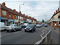
Ball Hill
Ball Hill is a busy local shopping centre on Walsgrave Road, on the East Side of Coventry. It is usually choked with traffic
Image: © Kevin Croucher
Taken: 13 Jun 2005
0.11 miles

6
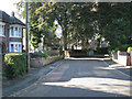
West Avenue, Stoke Park, Coventry CV2
"The area known as Stoke Park was developed from the 1860s and is completely surrounded by a curving sandstone wall…some sources suggest that this is the site of the old racecourse."
David McGrory. The Illustrated History of Coventry's Suburbs. Derby: Breedon Books, 2003. ISBN 1 85983 343 8
Image: © Robin Stott
Taken: 9 Aug 2012
0.14 miles
7
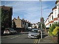
South end of Harefield Road, Coventry CV2
"In 1911 when ex-councillor Howells was developing the Harefield estate between the Stoke Road and Walsgrave Road an unusual find was made. Stonework was revealed and the men uncovered the huge remains of a set of mediaeval tile kilns…"
See David McGrory. The Illustrated History of Coventry's Suburbs. Derby: Breedon Books, 2003. ISBN 1 85983 343 8
John Brightley adds: This may be of interest: http://archaeologydataservice.ac.uk/catalogue/adsdata/arch-703-1/dissemination/pdf/northamp3-29981_1.pdf which notes that the tile kilns were near to the north end of Harefield Road.
Image: © Robin Stott
Taken: 9 Aug 2012
0.15 miles
8
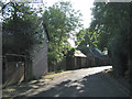
South Avenue, Stoke Park, Coventry CV2
"The area known as Stoke Park was developed from the 1860s and is completely surrounded by a curving sandstone wall…some sources suggest that this is the site of the old racecourse."
David McGrory. The Illustrated History of Coventry's Suburbs. Derby: Breedon Books, 2003. ISBN 1 85983 343 8
Image: © Robin Stott
Taken: 9 Aug 2012
0.15 miles
9
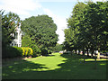
Open space by Binley Road, Coventry CV3
The local name for this is not known; it could be part of Stoke Park.
Image: © Robin Stott
Taken: 9 Aug 2012
0.15 miles
10
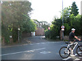
Junction of South Avenue and Bray's Lane, Coventry CV2
"The area known as Stoke Park was developed from the 1860s and is completely surrounded by a curving sandstone wall…some sources suggest that this is the site of the old racecourse."
David McGrory. The Illustrated History of Coventry's Suburbs. Derby: Breedon Books, 2003. ISBN 1 85983 343 8
Image: © Robin Stott
Taken: 9 Aug 2012
0.16 miles