IMAGES TAKEN NEAR TO
Dennis Road, COVENTRY, CV2 3HR
Introduction
This page details the photographs taken nearby to Dennis Road, CV2 3HR by members of the Geograph project.
The Geograph project started in 2005 with the aim of publishing, organising and preserving representative images for every square kilometre of Great Britain, Ireland and the Isle of Man.

There are currently over 7.5m images from over14,400 individuals and you can help contribute to the project by visiting https://www.geograph.org.uk
Image Map
Images are licensed for reuse under creativecommons.org/licenses/by-sa/2.0
Notes
- Clicking on the map will re-center to the selected point.
- The higher the marker number, the further away the image location is from the centre of the postcode.
Image Listing (6 Images Found)
Images are licensed for reuse under creativecommons.org/licenses/by-sa/2.0
Image
Details
Distance
1

Sub station on Blackberry Lane, close to the Sewall Highway junction
Note the lintel which is made by sandwiching layers of mortar between a series of vertical roof tiles.
Image: © starkderrick
Taken: 11 Oct 2011
0.17 miles
2
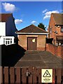
Electricity substation, Blackberry Lane
Nestled between two suburban homes, this substation is topped with a pitched and hipped roof and has its own front yard with wall, fence and gate; a little house for the electric gods.
Image: © A J Paxton
Taken: 8 Oct 2022
0.18 miles
3
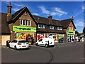
The Grange, now a Co-op store, Stoke, Coventry
The Grange public house on Alfall Road opened in 1937, according to the Coventry's Pub History site https://pubhistory.historiccoventry.co.uk/main/pub.php?pg=grange . It took its name from Wyken Grange Farm, on which the houses in this area were built. The pub closed in 2013 and reopened as a convenience store of the Heart of England Co-operative Society in 2016. Note the outdoor automatic mini-laundrette facing onto the car park just beyond the store entrance.
Image: © A J Paxton
Taken: 7 Aug 2022
0.22 miles
4
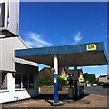
Disused garage, corner of Dennis Road and Alfall Road, Coventry
The former Grange pub, now a Co-op store, can be seen across Dennis Road.
Image: © A J Paxton
Taken: 7 Aug 2022
0.23 miles
5
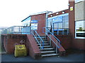
Entrance to the Sports Hall Reception, Lyng Hall School
Image: © Keith Williams
Taken: 13 May 2015
0.24 miles