
IMAGES TAKEN NEAR TO
Norton Hill Drive, COVENTRY, CV2 3AU
Introduction
This page details the photographs taken nearby to Norton Hill Drive, CV2 3AU by members of the Geograph project.
The Geograph project started in 2005 with the aim of publishing, organising and preserving representative images for every square kilometre of Great Britain, Ireland and the Isle of Man.

There are currently over 7.5m images from over14,400 individuals and you can help contribute to the project by visiting https://www.geograph.org.uk
Image Map
Images are licensed for reuse under creativecommons.org/licenses/by-sa/2.0
Notes
- Clicking on the map will re-center to the selected point.
- The higher the marker number, the further away the image location is from the centre of the postcode.
Image Listing (17 Images Found)
Images are licensed for reuse under creativecommons.org/licenses/by-sa/2.0
Image
Details
Distance

2

Stop for city-bound buses, Ansty Road, Wyken, Coventry
This is just northeast of Caludon Park Avenue. Ansty Road is A4600, leading to M6, M69, retail and business parks – and Ansty.
Image: © Robin Stott
Taken: 1 Oct 2015
0.11 miles
3
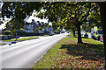
Southwest on Ansty Road, A4600, Wyken, Coventry
It's the way to the city centre. In view is the junction with Caludon Park Avenue.
Image: © Robin Stott
Taken: 1 Oct 2015
0.13 miles
4

Flood at University Hospital Coventry
I have another photo of the Air Ambulance on exactly this spot in square SP3780. Here is a pile of rubble where that air ambulance stood, entirely surrounded by the river water that is flowing onto the car park at the back of the Clinical Sciences Research Institute, University Hospital Coventry.
Image: © Helga Perry
Taken: 15 Jun 2007
0.14 miles
5
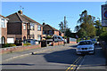
Caludon Park Avenue, Wyken, Coventry
The gates to Caludon Castle Park are opposite the south end of this short road.
Image: © Robin Stott
Taken: 1 Oct 2015
0.16 miles
6
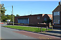
Telephone exchange, corner of Ansty Road and Clifford Bridge Road, Coventry
Image: © Robin Stott
Taken: 1 Oct 2015
0.18 miles
7
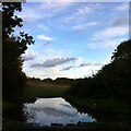
Puddle in the path, Wyken Croft
After heavy autumn rains, a puddle blocks the way, but reflects scudding clouds in the dusk sky.
Wyken Croft Nature Park occupies the site of Craven Colliery, which closed in 1927; see the Coventry Society website here https://www.coventrysociety.org.uk/coventry-neighbourhoods/wyken.html. The site was later used as a refuse dump. It has since been rehabilitated by the city council with landscaping, new topsoil and planting of trees and wildflowers. The site forms part of the Sowe Valley footpath route that follows the River Sowe around the eastern side of Coventry. See the city council site here https://www.coventry.gov.uk/directory_record/371/wyken_croft_nature_park .
Image: © A J Paxton
Taken: 30 Oct 2021
0.18 miles
8
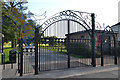
Gates to Caludon Castle Park, Farren Road, Wyken, Coventry
A pedestrian entrance is open, left.
Image: © Robin Stott
Taken: 1 Oct 2015
0.19 miles
9
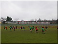
Wyken
Pinley v Admirals (Rugby) at Wyken near to Wyken Croft School
Image: © Ian Rob
Taken: 15 Jan 2006
0.19 miles
