
IMAGES TAKEN NEAR TO
Willowford Close, RUGBY, CV23 9FH
Introduction
This page details the photographs taken nearby to Willowford Close, CV23 9FH by members of the Geograph project.
The Geograph project started in 2005 with the aim of publishing, organising and preserving representative images for every square kilometre of Great Britain, Ireland and the Isle of Man.

There are currently over 7.5m images from over14,400 individuals and you can help contribute to the project by visiting https://www.geograph.org.uk
Image Map
Images are licensed for reuse under creativecommons.org/licenses/by-sa/2.0
Notes
- Clicking on the map will re-center to the selected point.
- The higher the marker number, the further away the image location is from the centre of the postcode.
Image Listing (31 Images Found)
Images are licensed for reuse under creativecommons.org/licenses/by-sa/2.0
Image
Details
Distance
1
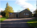
Long Lawford-School Street
The Methodist Church.
Image: © Ian Rob
Taken: 30 Oct 2007
0.05 miles
2
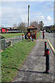
Townsend Lane, Long Lawford
The bollards prevent parking on the pavement, a potential problem here with a Co-op store opposite the bus shelter (out of shot). To the left is the King George V playing field and in the distance is Rugby Cement Works (many of whose employees were housed in Long Lawford). The shelter is served by buses from Coventry heading towards Rugby.
Image: © Stephen McKay
Taken: 18 Feb 2021
0.07 miles
3
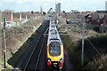
Railway at Long Lawford
The photographer is standing on Back Lane bridge as the 1234 London Euston - Edinburgh via Birmingham sweeps underneath. Although Long Lawford is immediately adjacent to the railway, there has never been a station here. In the distance is Rugby Cement Works.
Image: © Stephen McKay
Taken: 18 Feb 2021
0.08 miles
4
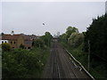
Looking along the track towards Rugby
From Chapel Street bridge looking along the track towards Rugby
Image: © Shaun Ferguson
Taken: 30 May 2016
0.11 miles
5
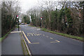
Back Lane, Long Lawford
Back Lane leads into the centre of Long Lawford village; immediately ahead it swings to the right and across a railway bridge where traffic is controlled with lights. The bus stops are used by the Rugby - Coventry service; note that raised pavements are provided to ease access to the vehicles.
Image: © Stephen McKay
Taken: 18 Feb 2021
0.11 miles
6
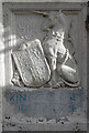
King George's Field heraldic panel
This panel is to the right of the gateway into the King George V playing field on School Street at Long Lawford. See Image for a wider view and Image for the panel to the left.
Image: © Stephen McKay
Taken: 18 Feb 2021
0.11 miles
7
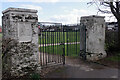
Gateway to King George V Playing Field, Long Lawford
Long Lawford was one of the 471 places to benefit from the King George V playing fields project. The field covers 5.5 acres and has this ornate gateway leading off School Street.
Image: © Stephen McKay
Taken: 18 Feb 2021
0.11 miles
8
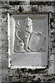
George V AD 1910-1936
This heraldic panel adorns the gateway to the King George V playing field at Long Lawford. George V reigned from 1910 to 1936. See Image for the wider context.
Image: © Stephen McKay
Taken: 18 Feb 2021
0.11 miles
9
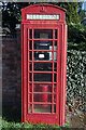
Telephone box - Main Street, Long Lawford
In common with so many village telephone boxes, the telephone has been removed and the BT notice announcing this can be seen inside.
Image: © Stephen McKay
Taken: 27 Feb 2021
0.11 miles
10
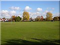
Long Lawford-Playing Field
King George V Playing Field and the Primary School beyond.
Image: © Ian Rob
Taken: 30 Oct 2007
0.12 miles