
IMAGES TAKEN NEAR TO
Marconi Close, RUGBY, CV23 1AT
Introduction
This page details the photographs taken nearby to Marconi Close, CV23 1AT by members of the Geograph project.
The Geograph project started in 2005 with the aim of publishing, organising and preserving representative images for every square kilometre of Great Britain, Ireland and the Isle of Man.

There are currently over 7.5m images from over14,400 individuals and you can help contribute to the project by visiting https://www.geograph.org.uk
Image Map
Images are licensed for reuse under creativecommons.org/licenses/by-sa/2.0
Notes
- Clicking on the map will re-center to the selected point.
- The higher the marker number, the further away the image location is from the centre of the postcode.
Image Listing (23 Images Found)
Images are licensed for reuse under creativecommons.org/licenses/by-sa/2.0
Image
Details
Distance
1
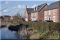
Hughes Drive, Houlton
These new houses on Hughes Drive overlook one of Houlton's 'wildlife corridors'.
Image: © Stephen McKay
Taken: 25 Mar 2021
0.16 miles
2

Faulkner Road, Houlton
Faulkner Road leads off Dollman Road close to the Dollman Farm local centre.
Image: © Stephen McKay
Taken: 25 Mar 2021
0.17 miles
3

Dollman Road, Houlton
More than three years after the first houses were occupied, some parts of Houlton were beginning to have an established feel by March 2021. This is the view along Dollman Way, named after the nearby farm which long predates Houlton, with Faulkner Road leading off to the right.
Image: © Stephen McKay
Taken: 25 Mar 2021
0.18 miles
4
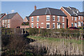
Hughes Drive, Houlton
Looking across one of Houlton's 'wildlife corridors' to new houses on Hughes Drive.
Image: © Stephen McKay
Taken: 25 Mar 2021
0.18 miles
5
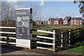
Welcome to Houlton
The board is intended to help orientate visitors to Houlton. In the background are houses on Dollman Road.
Image: © Stephen McKay
Taken: 25 Mar 2021
0.20 miles
6
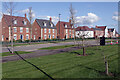
Dollman Road, Houlton
Seen from the car park of the Dollman Farm local centre, these houses are readily seen by passing traffic on the A428.
Image: © Stephen McKay
Taken: 25 Mar 2021
0.20 miles
7
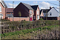
Hughes Drive, Houlton
Looking across one of Houlton's 'wildlife corridors' to new houses on Hughes Drive.
Image: © Stephen McKay
Taken: 25 Mar 2021
0.21 miles
8
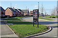
Houlton Way, Houlton
Houlton Way is one of the main thoroughfares through Houlton. It is seen here from the junction with Gabriel's Way where a sign points visitors to some of the housing developments and St Gabriel's Academy.
Image: © Stephen McKay
Taken: 25 Mar 2021
0.21 miles
9
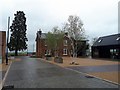
Houlton-Dollman's Farm
Farm House on the former site of Rugby Radio Station. It is now the Visitor Centre for the development of over 6,000 houses to be built here. The new district of Rugby is named Houlton after its namesake in Maine. USA where the first Trans Atlantic Signal from Rugby was received in 1927.
Image: © Ian Rob
Taken: 17 Apr 2017
0.21 miles
10
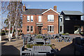
Houlton Visitor Centre
Houlton is a development on such a scale that it merits its own visitor centre. The location chosen was Dollman Farm close to the entrance to the site from the A428. The farm itself long predated the creation of Houlton. Inside there are displays showing how the estate will look when it is completed and some of the history associated with the location. The outside seating belongs to the adjacent Tuning Fork cafe and restaurant which was closed at the time of this photograph due to Covid-19 restrictions.
Image: © Stephen McKay
Taken: 25 Mar 2021
0.21 miles