
IMAGES TAKEN NEAR TO
Tollard Close, COVENTRY, CV2 2JF
Introduction
This page details the photographs taken nearby to Tollard Close, CV2 2JF by members of the Geograph project.
The Geograph project started in 2005 with the aim of publishing, organising and preserving representative images for every square kilometre of Great Britain, Ireland and the Isle of Man.

There are currently over 7.5m images from over14,400 individuals and you can help contribute to the project by visiting https://www.geograph.org.uk
Image Map
Images are licensed for reuse under creativecommons.org/licenses/by-sa/2.0
Notes
- Clicking on the map will re-center to the selected point.
- The higher the marker number, the further away the image location is from the centre of the postcode.
Image Listing (54 Images Found)
Images are licensed for reuse under creativecommons.org/licenses/by-sa/2.0
Image
Details
Distance
1
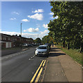
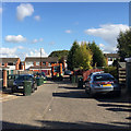
West on Dorchester Way, north end, Walsgrave, Coventry
In view is the bus stop Image The River Sowe and the Sowe Valley footpath run among the trees on the right.
Image: © Robin Stott
Taken: 14 Oct 2015
0.06 miles
2
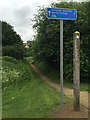
Link to the Sowe Valley Footpath from Dorchester Way, Walsgrave, east Coventry
It's a shortcut on foot to the University Hospital and a cycle route to Henley College (not sure how that works). Henley College is nearer to Bell Green than Henley Green.
Image: © Robin Stott
Taken: 13 Jun 2016
0.06 miles
4
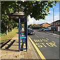
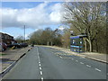
Bus stop, northwest end of Dorchester Way, Walsgrave, Coventry
Bus numbers 16, 16A and X31 serve this road. The River Sowe and the Sowe Valley footpath run among the trees on the left.
Image: © Robin Stott
Taken: 14 Oct 2015
0.06 miles
5
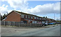
Bin day, Dorchester Way, Walsgrave, Coventry
Image: © Robin Stott
Taken: 20 Oct 2015
0.07 miles
7
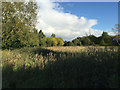
Tall herb vegetation in the River Sowe floodplain, Walsgrave, Coventry
Thistles, nettles and tall grasses may not be the most attractive sight but they support lots of wildlife. Seen from the informal footpath that cuts across to Dorchester Way.
Image: © Robin Stott
Taken: 14 Oct 2015
0.08 miles
8

Carpet of fallen leaves of Norway Maple, Walsgrave, Coventry
Coventry and Warwickshire enjoyed remarkable autumn colour in 2015. Here, a buffer strip of land between Clifford Bridge Road and the Dorchester Way estate has been planted with mainly Norway Maple (Acer platanoides). Leaves in the shade turned pale yellow while those in the sun were vivid orange and crimson.
Image: © Robin Stott
Taken: 2 Nov 2015
0.08 miles
9
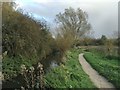
The Sowe Valley footpath and the River Sowe, Walsgrave, Coventry
The river is flowing away from the camera. The path to the right is a link to Dorchester Way.
Image: © Robin Stott
Taken: 13 Nov 2015
0.08 miles
10
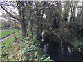
River Sowe and the Sowe Valley footpath, Walsgrave, Coventry
This is the stretch north of Dorchester Way and south of the University Hospital. The river is flowing towards the camera.
Image: © Robin Stott
Taken: 13 Nov 2015
0.08 miles