
IMAGES TAKEN NEAR TO
Viola Road, RUGBY, CV22 7WL
Introduction
This page details the photographs taken nearby to Viola Road, CV22 7WL by members of the Geograph project.
The Geograph project started in 2005 with the aim of publishing, organising and preserving representative images for every square kilometre of Great Britain, Ireland and the Isle of Man.

There are currently over 7.5m images from over14,400 individuals and you can help contribute to the project by visiting https://www.geograph.org.uk
Image Map
Images are licensed for reuse under creativecommons.org/licenses/by-sa/2.0
Notes
- Clicking on the map will re-center to the selected point.
- The higher the marker number, the further away the image location is from the centre of the postcode.
Image Listing (17 Images Found)
Images are licensed for reuse under creativecommons.org/licenses/by-sa/2.0
Image
Details
Distance
1
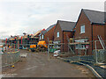
New houses at Cawston
Houses in various stages of construction on the Linden Homes' 'The Spinneys' development.
Image: © Stephen McKay
Taken: 21 Jan 2021
0.07 miles
2

Cawston
The old part of Cawston, seen from the footpath to Lawford Heath.
Image: © Ian Rob
Taken: 6 Jun 2006
0.09 miles
3

The old part of Cawston
The original hamlet was a ribbon of houses on the north side of the A4071. The population has expanded with the large Cawston Grange Estate development which now almost links it to Bilton.
Image: © Ian Rob
Taken: 29 Dec 2007
0.09 miles
4
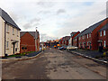
Harrowell Close, Cawston
Some of the new houses along this road are already occupied, others are awaiting their first residents. This is part of the Linden Homes' 'The Spinneys' development at the southern end of Cawston.
Image: © Stephen McKay
Taken: 21 Jan 2021
0.10 miles
5

Trussell Way, Cawston
Trussell Way ends at a gate beyond which is the Linden Homes' building site. This is all part of their 'The Spinneys' development at the southern end of Cawston.
Image: © Stephen McKay
Taken: 21 Jan 2021
0.13 miles

7
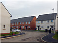
Harrowell Close, Cawston
These brand new houses are part of Linden Homes' 'The Spinneys' development at the southern end of Cawston. They are seen here from Arnold Drive.
Image: © Stephen McKay
Taken: 21 Jan 2021
0.14 miles
8

Arnold Drive, Cawston
Arnold Drive is one of the roads that comprise Linden Homes' 'The Spinneys' development at the southern end of Cawston. In this view the houses appear to be occupied already although the roadway needs to be finished off; a Royal Mail van can be seen making deliveries. Some of the roads on this estate are named after characters in 'Tom Brown's Schooldays', a novel by Thomas Hughes describing life at Rugby School in the 1830s. Dr Thomas Arnold was both the actual headmaster at the time and the fictional headmaster in the story.
Image: © Stephen McKay
Taken: 21 Jan 2021
0.16 miles
9
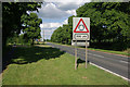
A4071 at Cawston
The roundabout 200 yards ahead is a relatively new feature, built to give access to the Cawston Grange Estate.
Image: © Stephen McKay
Taken: 14 Jun 2009
0.16 miles
10
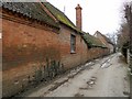
Cawston Farm
The footpath runs alongside the farm.
Image: © Ian Rob
Taken: 9 Feb 2012
0.18 miles