IMAGES TAKEN NEAR TO
Westbourne Grove, RUGBY, CV22 6BH
Introduction
This page details the photographs taken nearby to Westbourne Grove, CV22 6BH by members of the Geograph project.
The Geograph project started in 2005 with the aim of publishing, organising and preserving representative images for every square kilometre of Great Britain, Ireland and the Isle of Man.

There are currently over 7.5m images from over14,400 individuals and you can help contribute to the project by visiting https://www.geograph.org.uk
Image Map
Images are licensed for reuse under creativecommons.org/licenses/by-sa/2.0
Notes
- Clicking on the map will re-center to the selected point.
- The higher the marker number, the further away the image location is from the centre of the postcode.
Image Listing (32 Images Found)
Images are licensed for reuse under creativecommons.org/licenses/by-sa/2.0
Image
Details
Distance
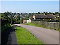
1
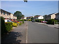
Rugby-Overslade Estate
Steel built homes in Wentworth Road.
Image: © Ian Rob
Taken: 9 Aug 2007
0.06 miles
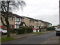
2
Rugby-Wentworth Road
The eastern side of Overslade Estate.This small section of Wentworth Road is unusual in that the houses are private and brick built as opposed to the rest of the estate being steel built council houses.
Image: © Ian Rob
Taken: 9 Aug 2007
0.08 miles
3
Rugby - Overslade
Much has been done recently to improve this sprawling 1940s Estate often unkindly referred to by locals as Tintown.Many of the original Steel houses have been demolished and replaced with brick built homes.Remaining Council owned properties have been re-rooved and an extra skin of bricks and pebble -dashed concrete added.The 4th and 5th houses in this row appear to be in their original state and are probably privately owned
Image: © Ian Rob
Taken: 14 Dec 2005
0.09 miles
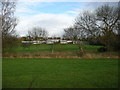
5
Rugby-Merttens Drive
Looking across the valley to Overslade.
Image: © Ian Rob
Taken: 1 Jun 2007
0.13 miles
6
Rugby-Saint Marie's Primary School
Next to the footpath which runs from the town centre to Overslade.
Image: © Ian Rob
Taken: 31 Dec 2010
0.14 miles
7
Rugby - Saint Marie's School
Roman Catholic Primary School on Merttens Drive.
Image: © Ian Rob
Taken: 8 Jan 2008
0.14 miles
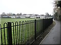
8
Overslade Estate Rugby
Green behind Wentworth Road.Saint Maries church spire can be seen.
Image: © Ian Rob
Taken: 27 Jul 2009
0.15 miles
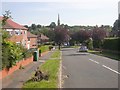
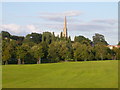
9
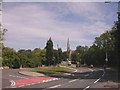
Rugby - Dunchurch Road
At the bottom of the hill leading up into Rugby. St Marie's Church at top.
Image: © Ian Rob
Taken: 3 Jul 2005
0.17 miles
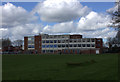
10
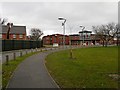
Rugby-Harris School
A view of the recently completed extension and some of the houses built on land that was previously part of the school.
Image: © Ian Rob
Taken: 26 Dec 2011
0.17 miles