
IMAGES TAKEN NEAR TO
Kennet Close, COVENTRY, CV2 1QS
Introduction
This page details the photographs taken nearby to Kennet Close, CV2 1QS by members of the Geograph project.
The Geograph project started in 2005 with the aim of publishing, organising and preserving representative images for every square kilometre of Great Britain, Ireland and the Isle of Man.

There are currently over 7.5m images from over14,400 individuals and you can help contribute to the project by visiting https://www.geograph.org.uk
Image Map
Images are licensed for reuse under creativecommons.org/licenses/by-sa/2.0
Notes
- Clicking on the map will re-center to the selected point.
- The higher the marker number, the further away the image location is from the centre of the postcode.
Image Listing (10 Images Found)
Images are licensed for reuse under creativecommons.org/licenses/by-sa/2.0
Image
Details
Distance
1
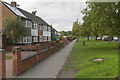
Henley Road
These houses are set well back from Henley Road which is the B4082. Along the road is an eclectic mix of houses.
Image: © Malcolm Neal
Taken: 29 Sep 2017
0.05 miles
2
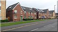
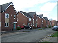
Deedmore Road
Modern housing stock on Deedmore Road, Coventry.
Image: © Peter Mackenzie
Taken: 27 Jul 2017
0.08 miles
3
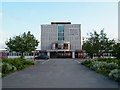
Henley College
Further Education College on the North side of Coventry.
Image: © Kevin Croucher
Taken: 13 Jun 2005
0.09 miles
6
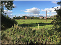
Suburban farmland, Henley Green, Coventry
Cows chew the cud on a sunny afternoon in early autumn. This pasture is in the floodplain of the River Sowe, foreground. From an aerial photo it appears to be part of Henley Farm off Henley Mill Lane. The view is from the open space to the rear of Parry Road. Looking north, we see the rear of houses in Brierley Road CV2, right, and Henley Mill Lane, left, with Henley College showing beyond it. The tower block of flats is Dewis House in Riley Square, Bell Green Image
Image: © Robin Stott
Taken: 2 Oct 2016
0.12 miles
7
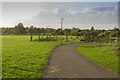
Bell Green
This is quite a large urban park set amidst typical suburban housing.
Image: © Malcolm Neal
Taken: 29 Sep 2017
0.18 miles
8
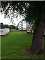
Willow tree, tower blocks and garages, Bell Green, Coventry
Framed by a willow tree, three four-storey housing blocks can be seen, part of a row of nine that stretch the length of Purcell Road in a sinuous double curve. The River Sowe flows among the trees to the left behind the garages. The photo was taken from Henley Road.
Image: © A J Paxton
Taken: 27 Jul 2021
0.20 miles
9
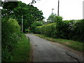
Henley Mill Lane, Coventry
A remarkably unspoilt surviving country lane within the depths of Coventry suburbia.
The farmland either side has not been built upon as it forms part of the River Sowe flood plain.
The edge of Henley College grounds are behind the hedge on the right.
Image: © John Brightley
Taken: 25 May 2010
0.21 miles
10
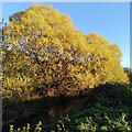
Willows by the River Sowe, Henley Green
They fit the description for crack willow, Salix fragilis, but willow species hybridise freely, according to the Woodland Trust site, with hybrid forms of crack willow and white willow, Salix alba, being especially common. It is mid-November and the leaves have turned a brilliant yellow.
Image: © A J Paxton
Taken: 11 Nov 2023
0.24 miles