Suburban farmland, Henley Green, Coventry
Introduction
The photograph on this page of Suburban farmland, Henley Green, Coventry by Robin Stott as part of the Geograph project.
The Geograph project started in 2005 with the aim of publishing, organising and preserving representative images for every square kilometre of Great Britain, Ireland and the Isle of Man.

There are currently over 7.5m images from over 14,400 individuals and you can help contribute to the project by visiting https://www.geograph.org.uk
Suburban farmland, Henley Green, Coventry
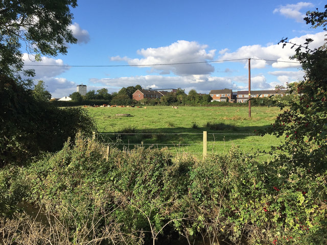
Image: © Robin Stott Taken: 2 Oct 2016
Cows chew the cud on a sunny afternoon in early autumn. This pasture is in the floodplain of the River Sowe, foreground. From an aerial photo it appears to be part of Henley Farm off Henley Mill Lane. The view is from the open space to the rear of Parry Road. Looking north, we see the rear of houses in Brierley Road CV2, right, and Henley Mill Lane, left, with Henley College showing beyond it. The tower block of flats is Dewis House in Riley Square, Bell Green Image
Images are licensed for reuse under creativecommons.org/licenses/by-sa/2.0
Image Location
Latitude
52.430194
Longitude
-1.467984