
IMAGES TAKEN NEAR TO
Wood Street, RUGBY, CV21 2NN
Introduction
This page details the photographs taken nearby to Wood Street, CV21 2NN by members of the Geograph project.
The Geograph project started in 2005 with the aim of publishing, organising and preserving representative images for every square kilometre of Great Britain, Ireland and the Isle of Man.

There are currently over 7.5m images from over14,400 individuals and you can help contribute to the project by visiting https://www.geograph.org.uk
Image Map
Images are licensed for reuse under creativecommons.org/licenses/by-sa/2.0
Notes
- Clicking on the map will re-center to the selected point.
- The higher the marker number, the further away the image location is from the centre of the postcode.
Image Listing (197 Images Found)
Images are licensed for reuse under creativecommons.org/licenses/by-sa/2.0
Image
Details
Distance
1
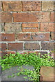
Benchmark on #136 Wood Street
Ordnance Survey cut mark benchmark described on the Bench Mark Database at http://www.bench-marks.org.uk/bm56918
Image: © Roger Templeman
Taken: 17 Apr 2014
0.01 miles
2
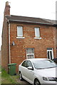
#136 Wood Street
There is an OS benchmark Image on the front of the house between the wheelie bin and the car
Image: © Roger Templeman
Taken: 17 Apr 2014
0.01 miles
3
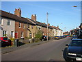
Rugby-Wood Street
Terraced housing which used to back onto the railway. There is a small industrial estate behind them now.
Image: © Ian Rob
Taken: 31 Jul 2007
0.02 miles
4

Rugby-Wood Street
Modern offices on previously derelict land.
Image: © Ian Rob
Taken: 13 Jan 2009
0.02 miles
5
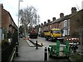
Rugby-Sycamore Grove
Road improvements in the Grove.
Image: © Ian Rob
Taken: 13 Jan 2009
0.02 miles
6
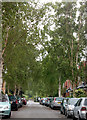
Acacia Grove looking south to Lancaster Road, Rugby
Image: © Andy F
Taken: 7 Jun 2009
0.04 miles
7
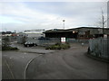
Rugby-Wood Street
Warehousebetween Wood street and The West coast mainline.
Image: © Ian Rob
Taken: 13 Jan 2009
0.04 miles
8
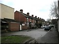
Rugby-Acacia Grove
Looking south towards Lancaster Road
Image: © Ian Rob
Taken: 13 Jan 2009
0.06 miles
9
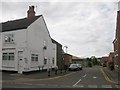
Rugby-Woodbridge Court
Leading to the footbridge over the West Coast Mainline. The white building was formerly a shop.
Image: © Ian Rob
Taken: 13 Jul 2008
0.06 miles
10
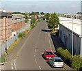
Woodside Park industrial units looking west
The view west along Woodside Way from the footbridge [http://www.geograph.org.uk/photo/1398623] over the west coast main line railway.
Image: © Andy F
Taken: 13 Jul 2009
0.07 miles