IMAGES TAKEN NEAR TO
Prospect Park, Valley Drive, RUGBY, CV21 1TF

Introduction

This page details the photographs taken nearby to Prospect Park, Valley Drive, CV21 1TF by members of the Geograph project.

The Geograph project started in 2005 with the aim of publishing, organising and preserving representative images for every square kilometre of Great Britain, Ireland and the Isle of Man.

There are currently over 7.5m images from over14,400 individuals and you can help contribute to the project by visiting https://www.geograph.org.uk

Image Map


Images are licensed for reuse under creativecommons.org/licenses/by-sa/2.0
Notes
  • Clicking on the map will re-center to the selected point.
  • The higher the marker number, the further away the image location is from the centre of the postcode.

Image Listing (35 Images Found)

Images are licensed for reuse under creativecommons.org/licenses/by-sa/2.0
  • ...
Image
Details
Distance
1
Rugby - Oxford Canal
Between Newbold and Brownsover.
Image: © Ian Rob Taken: 12 Nov 2005
0.10 miles
2
Brownsover-Swift Valley
Tree carving near the entrance to Swift Valley Park
Image: © Ian Rob Taken: 26 Jul 2008
0.14 miles
3
Tall trees and Bridge 56
On disused canal, north of Brownsover Lane, bridge 56 nestles amongst majestic tall trees on the border of Brownsover Hall Hotel grounds. From this bridge, there is access to country park car park below.
Image: © Michael Westley Taken: 18 Mar 2010
0.14 miles
4
Bridge 56, disused canal near Brownsover
Situated in wooded grounds alongside Brownsover Hall Hotel, this bridge links the hotel with country park below. See also Image]
Image: © Michael Westley Taken: 18 Mar 2010
0.15 miles
5
Brownsover-Old Canal
Bridge No 56 which is a footbridge over the disused canal into Brownsover Hall
Image: © Ian Rob Taken: 26 Jul 2008
0.15 miles
6
Swift Valley Nature Reserve
The nature reserve, consisting mainly of grassland and a disused canal, is owned by Rugby Borough Council and managed by Warwickshire Wildlife Trust. The paths here are designed to be accessible for disabled people.
Image: © Stephen McKay Taken: 16 Apr 2014
0.16 miles
7
Stone, Brownsover Arm, Oxford Canal
Possibly a milestone on the Western bank of the early route of the canal just North of bridge 56. This canal section leads to Cosford and was bypassed in the 1820s, but kept as a feeder from the river Swift. More information is on Wikipedia https://en.wikipedia.org/wiki/Oxford_Canal
Image: © Mr Red Taken: 11 Jul 2024
0.16 miles
8
Brownsover Hall Hotel - Bridge over Brownsover Arm
This old red-brick bridge crosses the Brownsover Arm of the Oxford Canal within the grounds of Image] The towpath is on the far side of the bridge and cannot be accessed from the grounds due to a padlocked gate at the far end of the bridge. I think that this locked gate is more to prevent people entering the hotel's grounds rather than to prevent guests from accessing the towpath however.
Image: © Rob Farrow Taken: 30 May 2021
0.17 miles
9
Grounds of Brownsover Hall Hotel
View of disused canal alongside grounds of hotel north of Brownsover Lane, Rugby. A very quiet and relaxing location.
Image: © Michael Westley Taken: 18 Mar 2010
0.17 miles
10
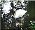
Mute Swan (Cygnus olor) on Brownsover Arm
The Mute Swan (Cygnus olor) is one of the world's heaviest flying birds with a weight for males of up to 20kg (44lbs) The example seen here is probably more like 11kg (23lbs) - it is probably a male as it has a notable 'knob' at the top of its beak (females have these too but they're usually less prominent). This one was floating about on the disused Brownsover Arm of the Oxford Canal. Cf (probable) female with cygnets Image]
Image: © Rob Farrow Taken: 30 May 2021
0.17 miles
  • ...