IMAGES TAKEN NEAR TO
Keswick Drive, RUGBY, CV21 1PN
Introduction
This page details the photographs taken nearby to Keswick Drive, CV21 1PN by members of the Geograph project.
The Geograph project started in 2005 with the aim of publishing, organising and preserving representative images for every square kilometre of Great Britain, Ireland and the Isle of Man.

There are currently over 7.5m images from over14,400 individuals and you can help contribute to the project by visiting https://www.geograph.org.uk
Image Map
Images are licensed for reuse under creativecommons.org/licenses/by-sa/2.0
Notes
- Clicking on the map will re-center to the selected point.
- The higher the marker number, the further away the image location is from the centre of the postcode.
Image Listing (9 Images Found)
Images are licensed for reuse under creativecommons.org/licenses/by-sa/2.0
Image
Details
Distance
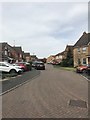
2
Rugby-Brownsover Estate
Looking down Hollowell Way to the western side of the estate.
Image: © Ian Rob
Taken: 23 Jan 2008
0.16 miles
3
Rugby-Whimbrel Close
Part of the Coton Meadows Estate.
Image: © Ian Rob
Taken: 5 May 2013
0.16 miles
4
Brownsover-Hollowell Way
The approach to the local shopping parade.
Image: © Ian Rob
Taken: 29 Nov 2007
0.19 miles
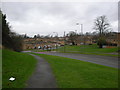
5
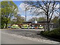
Rugby Ambulance Station
On Brownsover Lane close to Junction 1 of the M6 Motorway.
Image: © Ian Rob
Taken: 5 May 2013
0.21 miles
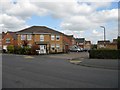
6
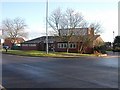
Brownsover-The Merry Monk
Public House in the centre of this large housing estate.
Image: © Ian Rob
Taken: 29 Nov 2007
0.22 miles
7
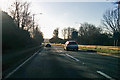
A426 Leicester Road, Rugby
Heading towards the town centre.
Image: © Robin Webster
Taken: 7 Jan 2018
0.24 miles
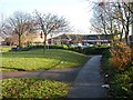
8
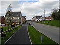
Rugby-Eden Park
A new housing development in north Rugby, close to Brownsover, with views over Swift Valley.
Image: © Ian Rob
Taken: 5 May 2013
0.25 miles
9
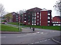
Rugby - Brownsover
Flats on Hollowell Way, which is the main road through this large Estate.
Image: © Ian Rob
Taken: 21 Apr 2006
0.25 miles