
IMAGES TAKEN NEAR TO
Aventine Way, RUGBY, CV21 1HA
Introduction
This page details the photographs taken nearby to Aventine Way, CV21 1HA by members of the Geograph project.
The Geograph project started in 2005 with the aim of publishing, organising and preserving representative images for every square kilometre of Great Britain, Ireland and the Isle of Man.

There are currently over 7.5m images from over14,400 individuals and you can help contribute to the project by visiting https://www.geograph.org.uk
Image Map
Images are licensed for reuse under creativecommons.org/licenses/by-sa/2.0
Notes
- Clicking on the map will re-center to the selected point.
- The higher the marker number, the further away the image location is from the centre of the postcode.
Image Listing (39 Images Found)
Images are licensed for reuse under creativecommons.org/licenses/by-sa/2.0
Image
Details
Distance
1
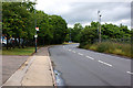
Cosford Lane, Swift Park Industrial Estate
Image: © Ian Greig
Taken: 15 Jul 2010
0.10 miles
2
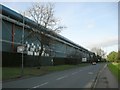
Rugby-Cosford Lane
The Continental Can Company's imposing factory runs almost the length of the lane. Beer and soft drinks cans are manufactured here and there is a link to the neighbouring Britvic Factory.
Image: © Ian Rob
Taken: 27 Jan 2008
0.13 miles
3
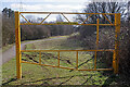
Viaduct Cycleway
From here on Brownsover Road the cycleway heads south towards Rugby town centre. The yellow gate is obviously intended for maintenance vehicles; cyclists and walkers do not have to pass through it.
Image: © Stephen McKay
Taken: 9 Mar 2021
0.16 miles
4
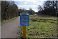
Viaduct Cycleway
The sign asks: 'Why are you tossing litter around here?' (I wasn't!)
Image: © Stephen McKay
Taken: 9 Mar 2021
0.16 miles
5
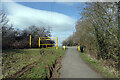
Viaduct Cycleway
Approaching the Brownsover Road end of the cycleway.
Image: © Stephen McKay
Taken: 9 Mar 2021
0.16 miles
6
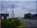
Rugby-Glebe Farm Industrial Estate
At the junction of Glebe Farm Road and Consul Road.
Image: © Ian Rob
Taken: 31 Jul 2011
0.18 miles
7
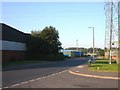
Rugby - Glebe Farm
Units on the Glebe Farm Industrial Estate.
Image: © Ian Rob
Taken: 3 Aug 2006
0.18 miles
8
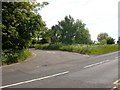
Newbold-Brownsover Road
Turning point for HGVs that overshoot the Cosford Lane junction on Swift Valley Industrial Estate. There is a weak bridge over the canal further down the road.
Image: © Ian Rob
Taken: 23 May 2009
0.20 miles
9
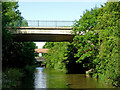
Canal bridges east of Newbold on Avon in Warwickshire
This is the Oxford Canal, looking west towards Bridge No 53, which carries Cosul Road.
Image: © Roger D Kidd
Taken: 21 Aug 2013
0.21 miles
10
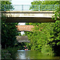
Three bridges near Newbold on Avon, Warwickshire
This is the Oxford Canal, looking west towards Bridge No 53, which carries Consul Road. Beyond it are Bridge No 52 and a former railway bridge.
Image: © Roger D Kidd
Taken: 21 Aug 2013
0.21 miles