
IMAGES TAKEN NEAR TO
Newbold Road, RUGBY, CV21 1EL
Introduction
This page details the photographs taken nearby to Newbold Road, CV21 1EL by members of the Geograph project.
The Geograph project started in 2005 with the aim of publishing, organising and preserving representative images for every square kilometre of Great Britain, Ireland and the Isle of Man.

There are currently over 7.5m images from over14,400 individuals and you can help contribute to the project by visiting https://www.geograph.org.uk
Image Map
Images are licensed for reuse under creativecommons.org/licenses/by-sa/2.0
Notes
- Clicking on the map will re-center to the selected point.
- The higher the marker number, the further away the image location is from the centre of the postcode.
Image Listing (100 Images Found)
Images are licensed for reuse under creativecommons.org/licenses/by-sa/2.0
Image
Details
Distance
1
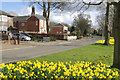
Newbold Road, Newbold on Avon
Looking towards Rugby on a pleasant Sunday afternoon in early spring. The north eastern side of Newbold Road has a variety of housing styles from different periods.
Image: © Stephen McKay
Taken: 9 Mar 2008
0.03 miles
2
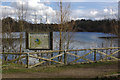
Newbold Quarry Park
Seen from the small car park accessible via Avonmere off Newbold Road, this nature reserve has been formed around an old flooded cement quarry. There is an important population of white-clawed crayfish in the lake.
Image: © Stephen McKay
Taken: 9 Mar 2008
0.03 miles
3
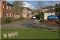
Avonmere, Newbold on Avon
Modern development off Newbold Road. The houses straight ahead back on to Newbold Quarry Park.
Image: © Stephen McKay
Taken: 9 Mar 2008
0.04 miles
4
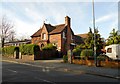
Newbold-On-Avon Old Schoolhouse
Now converted to a private house.
Image: © Ian Rob
Taken: 13 May 2012
0.04 miles
5
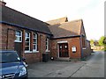
Newbold On Avon Village Hall
Making use of the old school building.
Image: © Ian Rob
Taken: 13 May 2012
0.04 miles
7
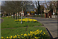
Newbold Road, Newbold on Avon
Looking along Newbold Road (B4112) towards the junction with Brownsover Road and Parkfield Road.
Image: © Stephen McKay
Taken: 9 Mar 2008
0.06 miles
8
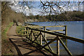
Newbold Quarry Park
Showing the pontoon built to allow access for diabled fishermen.
Image: © Stephen McKay
Taken: 9 Mar 2008
0.07 miles
9
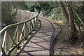
Newbold Quarry Park
Showing the path round the edge of the flooded cement quarry.
Image: © Stephen McKay
Taken: 9 Mar 2008
0.07 miles
10
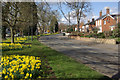
Newbold Road, Newbold on Avon
Newbold on Avon was incorporated into the Borough of Rugby in the 1930s. This is looking along the main street through the village, the B4112, out of town.
Image: © Stephen McKay
Taken: 9 Mar 2008
0.07 miles