
IMAGES TAKEN NEAR TO
Newbold Road, RUGBY, CV21 1DH
Introduction
This page details the photographs taken nearby to Newbold Road, CV21 1DH by members of the Geograph project.
The Geograph project started in 2005 with the aim of publishing, organising and preserving representative images for every square kilometre of Great Britain, Ireland and the Isle of Man.

There are currently over 7.5m images from over14,400 individuals and you can help contribute to the project by visiting https://www.geograph.org.uk
Image Map
Images are licensed for reuse under creativecommons.org/licenses/by-sa/2.0
Notes
- Clicking on the map will re-center to the selected point.
- The higher the marker number, the further away the image location is from the centre of the postcode.
Image Listing (112 Images Found)
Images are licensed for reuse under creativecommons.org/licenses/by-sa/2.0
Image
Details
Distance
1
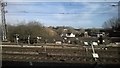
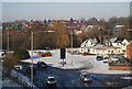
Rugby: crossing Newbold Road at speed
The white building is the Avon Mill pub.
Image: © Christopher Hilton
Taken: 24 Feb 2015
0.01 miles
3
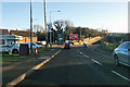
Newbold Road, Rugby
Heading towards the town centre.
Image: © Robin Webster
Taken: 7 Jan 2018
0.02 miles
4
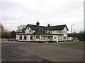
Rugby - Newbold Road
The Avon Mill Public House. Site of a mill on the River Avon (where the trees are). The car park in between was also an outdoor swimming pool until the late 1960s.
Image: © Ian Rob
Taken: 25 Jan 2006
0.03 miles
5
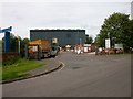
Rugby - Hunters Lane
The Recycling Centre (Rubbish Tip) run by the local council.
Image: © Ian Rob
Taken: 28 May 2006
0.03 miles
6
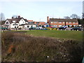
Rugby-Avon Mill
A view of the Public House and small terrace of houses, looking from the River Avon Bridge.
Image: © Ian Rob
Taken: 21 Mar 2010
0.03 miles
7
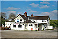
Avon Mill public house, Rugby
Recently closed.
Image: © Jim Osley
Taken: 6 Apr 2017
0.03 miles
8
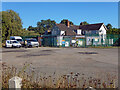
Avon Mill Inn, Rugby
This former pub closed for good in 2017, its landlord of 25 years declaring it no longer viable. Attempts to attract a new operator were unsuccessful and the building, which dates from the late 19th century, has become derelict. Although on a main road into Rugby town centre, its location is less than ideal - mostly surrounded by industrial premises some distance from the nearest housing (with the exception of four rather isolated 1960s dwellings immediately adjacent). Planning permission has been granted for the building to be demolished and replaced by a coffee shop with drive-through facilities. The presence of vehicles and workmen belonging to a demolition contractor suggests that the work has begun.
Image: © Stephen McKay
Taken: 20 Sep 2021
0.03 miles
9
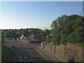
Newbold Road, Rugby
Viewed from the railway line.
Image: © Stephen Craven
Taken: 23 Jun 2014
0.03 miles
10
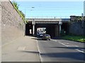
Rugby-Newbold Road
Traffic heading up to the Town Centre passes under the West Coast Mainline bridge.
Image: © Ian Rob
Taken: 24 Jul 2012
0.06 miles