
IMAGES TAKEN NEAR TO
Harnall Lane East, COVENTRY, CV1 5AG
Introduction
This page details the photographs taken nearby to Harnall Lane East, CV1 5AG by members of the Geograph project.
The Geograph project started in 2005 with the aim of publishing, organising and preserving representative images for every square kilometre of Great Britain, Ireland and the Isle of Man.

There are currently over 7.5m images from over14,400 individuals and you can help contribute to the project by visiting https://www.geograph.org.uk
Image Map
Images are licensed for reuse under creativecommons.org/licenses/by-sa/2.0
Notes
- Clicking on the map will re-center to the selected point.
- The higher the marker number, the further away the image location is from the centre of the postcode.
Image Listing (64 Images Found)
Images are licensed for reuse under creativecommons.org/licenses/by-sa/2.0
Image
Details
Distance
1
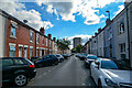
Coventry : Hartlepool Road
Looking along Hartlepool Road.
Image: © Lewis Clarke
Taken: 25 Sep 2021
0.07 miles
2
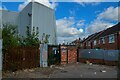
Coventry : Footpath
A footpath from Stoney Stanton Road to Hartlepool Road.
Image: © Lewis Clarke
Taken: 25 Sep 2021
0.10 miles
3
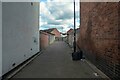
Coventry : Footpath
A footpath from Stoney Stanron Road to Hartlepool Road.
Image: © Lewis Clarke
Taken: 25 Sep 2021
0.12 miles
4
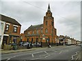
Hillfields, closed church
On Stoney Stanton Road; formerly a Wesleyan Church, dated 1898, now disused.
Image: © Mike Faherty
Taken: 19 Feb 2016
0.13 miles
5
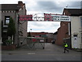
Ex Cash and Carry
This has been closed, and the sign in a similar state of repair, since at least 2008.
Image: © Keith Williams
Taken: 13 May 2015
0.14 miles
6

Coventry : Stoney Stanton Road
Passing shops on Stoney Stanton Road.
Image: © Lewis Clarke
Taken: 25 Sep 2021
0.14 miles
7
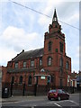
Islamic Brotherhood Family Centre
The stone carved at the front of this building declares it as a Wesleyan Chapel, 1896.
Image: © Keith Williams
Taken: 13 May 2015
0.14 miles
8
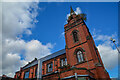
Coventry : Wesleyan Church
Former Methodist church on the corner of Stoney Stanton Road and Howard Street
Image: © Lewis Clarke
Taken: 25 Sep 2021
0.14 miles
9
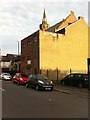
Former Methodist church, now a madrassah, corner of Stoney Stanton Road and Eagle Street, Coventry
Former Wesleyan Methodist church building, a red brick gothic structure with a tower and spire, built 1897-99 to a design by Harrison & Hattrell. https://manchestervictorianarchitects.org.uk/buildings/wesleyan-methodist-chapel-stoney-stanton-road-coventry It now houses the madrassah (supplementary school) and other activities of the nearby Eagle Street mosque. The building is seen here from the rear on Eagle Street; the mosque is behind the photographer.
Image: © A J Paxton
Taken: 14 Jun 2021
0.15 miles
10
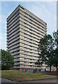
Pioneer House, Adelaide Street, Coventry
One of a number of similarly-styled tower blocks dotted about the northern fringes of Coventry, standing like sentries as if to provide early warning of incursions by Nuneaton or Hinckley. They are distinguished by projecting white concrete bands and closely resemble designs by City Architect, Arthur Ling. Built by him or his successor, Terence Gregory, in the early-mid 1960s.
Image: © Stephen Richards
Taken: 22 Aug 2011
0.15 miles