
IMAGES TAKEN NEAR TO
Brindley Paddocks, COVENTRY, CV1 4RG
Introduction
This page details the photographs taken nearby to Brindley Paddocks, CV1 4RG by members of the Geograph project.
The Geograph project started in 2005 with the aim of publishing, organising and preserving representative images for every square kilometre of Great Britain, Ireland and the Isle of Man.

There are currently over 7.5m images from over14,400 individuals and you can help contribute to the project by visiting https://www.geograph.org.uk
Image Map
Images are licensed for reuse under creativecommons.org/licenses/by-sa/2.0
Notes
- Clicking on the map will re-center to the selected point.
- The higher the marker number, the further away the image location is from the centre of the postcode.
Image Listing (382 Images Found)
Images are licensed for reuse under creativecommons.org/licenses/by-sa/2.0
Image
Details
Distance
1
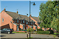
Draper's Fields
c.1990s housing alongside the Coventry Canal.
Image: © Ian Capper
Taken: 23 Sep 2021
0.05 miles
2
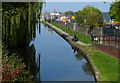
The Coventry Canal near the city centre
This is the southern end of the canal, just to the north of the Coventry Canal Basin. The canal ends 38 miles (65 km) north at Fradley Junction, near Lichfield.
This is the view from Bridge 1: Drapers Fields Bridge.
Image: © Mat Fascione
Taken: 11 Sep 2014
0.05 miles
3

Houses built on the site of Coventry Wharf
On the west side of the Coventry Canal, just north of Drapers Fields Bridge [no 1].
Image: © Christine Johnstone
Taken: 6 Jun 2025
0.05 miles
4
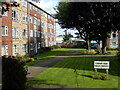
Elmwood Court, Coventry
Elmwood Court comprises 56 flats in a two-storey maisonette style, located to the east of St Nicholas Street and close to Coventry city centre.
Image: © Stephen McKay
Taken: 23 Sep 2021
0.05 miles
5
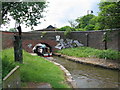
Negotiating Bridge No. 1
A narrowboat entering Coventry's Bishop Street canal basin, showing the limited clearance of Draper's Fields bridge. On the left is the artwork 'The Journeyman' by Stephen Hitchin. The effort on the right was presumably not commissioned.
The bridge from the other side: http://www.geograph.org.uk/photo/1565828
Another view of The Journeyman: http://www.geograph.org.uk/photo/373237
Image: © E Gammie
Taken: 9 Jun 2010
0.06 miles
6

Flats built on the site of Coventry Wharf
On the west side of the Coventry Canal, in Drapers Fields.
Image: © Christine Johnstone
Taken: 6 Jun 2025
0.06 miles
8
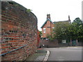
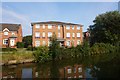
Canal House, Drapers Fields
Canal House, viewed across the hump-back Draper Fields Bridge (Bridge no.1)[1]. The house was used by Coventry Canal Company from 1809 until the nationalisation of the waterways in 1948. The curved brickwork in the foreground is part of the high bridge parapet - the handrail is set at a normal height!
The house can be clearly seen from a different angle on the left in this 1975 view: http://www.geograph.org.uk/photo/380245
A grade II listed building
Image: © E Gammie
Taken: 21 Oct 2009
0.06 miles
9
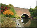
Bridge No. 1, Coventry Canal
Also known as Drapers Fields bridge[1], viewed from the Coventry canal basin side. Three different horizons can be seen in the brickwork above the arch.
Image: © E Gammie
Taken: 21 Oct 2009
0.06 miles
10
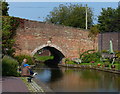
Bridge 1: Drapers Fields Bridge
This is the first bridge on the Coventry Canal, it is next to the Coventry Canal Basin. The canal ends 38 miles (65 km) north at Fradley Junction, near Lichfield.
Image: © Mat Fascione
Taken: 11 Sep 2014
0.06 miles