
IMAGES TAKEN NEAR TO
Drapers Fields, COVENTRY, CV1 4RA
Introduction
This page details the photographs taken nearby to Drapers Fields, CV1 4RA by members of the Geograph project.
The Geograph project started in 2005 with the aim of publishing, organising and preserving representative images for every square kilometre of Great Britain, Ireland and the Isle of Man.

There are currently over 7.5m images from over14,400 individuals and you can help contribute to the project by visiting https://www.geograph.org.uk
Image Map
Images are licensed for reuse under creativecommons.org/licenses/by-sa/2.0
Notes
- Clicking on the map will re-center to the selected point.
- The higher the marker number, the further away the image location is from the centre of the postcode.
Image Listing (338 Images Found)
Images are licensed for reuse under creativecommons.org/licenses/by-sa/2.0
Image
Details
Distance
1
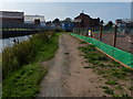
Towpath of the Coventry Canal
On the right is the construction of a new housing development called the City Wharf, it is being built on the site of the old city council works depot, off Foleshill Road.
Image: © Mat Fascione
Taken: 11 Sep 2014
0.03 miles
2

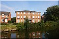
Four-storey canalside flats, Coventry
Built on part of the Daimler works site, just west of a small canal arm shown on the large-scale OS map surveyed in the 1880s.
Image: © Christine Johnstone
Taken: 6 Jun 2025
0.04 miles
3
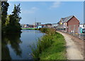
Construction along the Coventry Canal
The building under construction is the sales centre for the upcoming City Wharf housing development.
Image, similar view taken over 6 years later.
Image: © Mat Fascione
Taken: 11 Sep 2014
0.04 miles
4
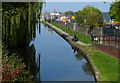
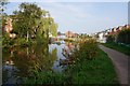
The Coventry Canal near the city centre
This is the southern end of the canal, just to the north of the Coventry Canal Basin. The canal ends 38 miles (65 km) north at Fradley Junction, near Lichfield.
This is the view from Bridge 1: Drapers Fields Bridge.
Image: © Mat Fascione
Taken: 11 Sep 2014
0.05 miles
5
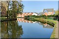
City Wharf housing development along the Coventry Canal
Image, similar view taken over 6 years earlier.
Image: © Mat Fascione
Taken: 7 Nov 2020
0.05 miles
7
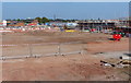
Construction of a new housing development
This new housing development is called the City Wharf, it is being built on the site of the old city council works depot, off Foleshill Road.
Image: © Mat Fascione
Taken: 11 Sep 2014
0.05 miles
9
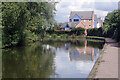
Coventry Canal, Draper's Field
Approaching the first bend on this contour canal after leaving Coventry basin, there are moorings provided for boats who cannot get into the rather limited facilities in the basin itself.
Image: © Stephen McKay
Taken: 11 Sep 2021
0.05 miles
10

Flats built on the site of Coventry Wharf
On the west side of the Coventry Canal, in Drapers Fields.
Image: © Christine Johnstone
Taken: 6 Jun 2025
0.05 miles