
IMAGES TAKEN NEAR TO
Cashs Lane, COVENTRY, CV1 4NN
Introduction
This page details the photographs taken nearby to Cashs Lane, CV1 4NN by members of the Geograph project.
The Geograph project started in 2005 with the aim of publishing, organising and preserving representative images for every square kilometre of Great Britain, Ireland and the Isle of Man.

There are currently over 7.5m images from over14,400 individuals and you can help contribute to the project by visiting https://www.geograph.org.uk
Image Map
Images are licensed for reuse under creativecommons.org/licenses/by-sa/2.0
Notes
- Clicking on the map will re-center to the selected point.
- The higher the marker number, the further away the image location is from the centre of the postcode.
Image Listing (127 Images Found)
Images are licensed for reuse under creativecommons.org/licenses/by-sa/2.0
Image
Details
Distance
1
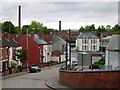
Cash's Lane, Coventry
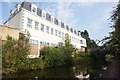
Looking from the bridge over the Coventry Canal towards Foleshill Road. The chimneys belonged to the defunct Webster's brick works which is scheduled for redevelopment.
Image: © Stephen McKay
Taken: 11 Aug 2006
0.02 miles
2
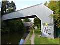
Pipebridge across the Coventry Canal
In the distance is bridge 2: Cash's Lane Bridge.
Image: © Mat Fascione
Taken: 11 Sep 2014
0.02 miles
3
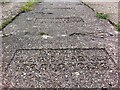
Paving slabs, Coventry Canal, Foleshill
Just south of the Cash's Lane canal bridge (Bridge no. 2), the canal towpath is paved with a row of over a hundred interlocking concrete paving slabs, each bearing the inscription 'DANGER C.E.G.B. CABLES 132,000 VOLTS'. The CEGB was the Central Electricity Generating Board, which had responsibility for generating and transmitting electricity in England & Wales from 1958 until the industry was privatised in the early 1990s. https://en.wikipedia.org/wiki/Central_Electricity_Generating_Board
Many of the slabs are loose and rock slightly underfoot, the cavity underneath for the cables acting as a resonator to amplify the sound, which is suggestive of a large out-of-tune marimba.
Image: © A J Paxton
Taken: 26 Aug 2021
0.02 miles
4
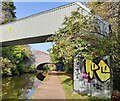
Pipebridge next to Cash's Lane Bridge No 2
Image: © Mat Fascione
Taken: 7 Nov 2020
0.02 miles
6
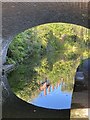
Cash?s Lane Bridge
Reflection of chimneys of Cash’s Hundred Houses in the Coventry Canal.
Image: © Alan Hughes
Taken: 23 Sep 2021
0.03 miles
7
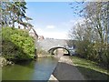
Bishopsgate Green, Bridge No 2
Carrying Cask's Lane over Coventry Canal.
Image: © Mike Faherty
Taken: 19 Feb 2016
0.03 miles
8
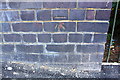
Benchmark on south parapet of Cash's Bridge
Ordnance Survey cut mark benchmark levelled at 95.908m above Newlyn Datum
Image: © Roger Templeman
Taken: 10 Jul 2018
0.03 miles
9
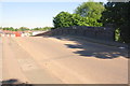
Cash's Bridge taking Cash's Lane over the Coventry Canal
There is an OS benchmark Image near the right hand end of the parapet
Image: © Roger Templeman
Taken: 10 Jul 2018
0.03 miles
10
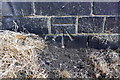
Benchmark on Cash's Bridge beside towpath
Ordnance Survey cut mark benchmark levelled at 93.059m above Newlyn Datum
Image: © Roger Templeman
Taken: 10 Jul 2018
0.03 miles