1
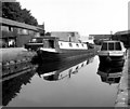
John Sinclair House, Coventry Canal Basin
This side of the canal basin has modern buildings, including John Sinclair House comprising office accommodation with some retail units on the ground floor, in contrast with the opposite side where there are 19th century warehouses. John Sinclair was the Coventry Canal Company's engineer from 1820 to 1863.
Image: © Stephen McKay
Taken: 17 Nov 2021
0.00 miles
2
The Basin from the Bridge: Bishop Street, Coventry
A view of Bishop Street Basin from the steps to the footbridge across the Ring Road. Drapers Fields Bridge No 1 is visible along the canal.
Image: © Dr Neil Clifton
Taken: 19 Apr 1975
0.01 miles
3
Bishop Street Basin, Coventry
The end of the five-mile arm from Hawkesbury Junction. Navigation of this arm, which has some severe bends, is not recommended for beginners.
Image: © Dr Neil Clifton
Taken: 3 Jul 1980
0.01 miles
4
Latvia & Portugal by the Coventry Canal
A Latvian shop and a Portuguese shop occupy retail units in John Sinclair House, fronting onto Coventry canal basin. The Latvian shop is called Rudens, which means autumn, hence the autumnal leaf displays in the windows. The Portuguese shop, Gorety, has cafe tables outside, popular in the summer months. The unit between them is occupied by a Riley project, dedicated to documenting the history of the Coventry car maker and building a replica of its first car; see
Image
Image: © A J Paxton
Taken: 3 Oct 2022
0.01 miles
5
Coventry Basin
Coventry (or Bishop Street) Basin lies at the end of the Coventry Canal close to the city centre. Seen here on a quiet overcast day, it is a pleasant place to stroll around.
Image: © Stephen McKay
Taken: 19 Oct 2008
0.01 miles
6
Basin End, Bishop Street Basin, Coventry
This is looking towards the end of the basin where the canal divides into two short bays. The well-known jazz musician and writer, Owen Bryce, lived in a narrow boat in this basin for some years and was resident when this photograph was taken in 1975.
Image: © Dr Neil Clifton
Taken: 19 Apr 1975
0.01 miles
7
Bishop Street Basin, Coventry Canal
This is looking back along the canal from its terminus. Draper's Field Bridge No 1 is in the distance.
Image: © Dr Neil Clifton
Taken: 30 Jun 1977
0.01 miles
8
Coventry Canal
Bridge No 1 at Draper's field.
Image: © Ian Rob
Taken: 25 Aug 2010
0.01 miles
9
Coventry Canal Basin
Old warehouses on the north arm of the canal basin have been renovated and repurposed.
Image: © Anne Burgess
Taken: 23 Sep 2021
0.01 miles
10
Rudens Baltic Food Store
Food shop catering to people from Latvia and other Baltic states and regions living in Coventry. It is located in a modern (1990s) building facing onto Coventry Canal Basin.
Image: © A J Paxton
Taken: 1 May 2021
0.01 miles


