1
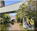
Junction of path and Widdrington Road, opposite house #214
There is an OS benchmark
Image on the wall pier at the left hand end of the brick wall
Image: © Roger Templeman
Taken: 10 Jul 2018
0.03 miles
2
Benchmark on wall junction on west side of Widdrington Road
Ordnance Survey cut mark benchmark levelled at 97.972m above Newlyn Datum
Image: © Roger Templeman
Taken: 10 Jul 2018
0.03 miles
3
Paving slabs, Coventry Canal, Foleshill
Just south of the Cash's Lane canal bridge (Bridge no. 2), the canal towpath is paved with a row of over a hundred interlocking concrete paving slabs, each bearing the inscription 'DANGER C.E.G.B. CABLES 132,000 VOLTS'. The CEGB was the Central Electricity Generating Board, which had responsibility for generating and transmitting electricity in England & Wales from 1958 until the industry was privatised in the early 1990s. https://en.wikipedia.org/wiki/Central_Electricity_Generating_Board
Many of the slabs are loose and rock slightly underfoot, the cavity underneath for the cables acting as a resonator to amplify the sound, which is suggestive of a large out-of-tune marimba.
Image: © A J Paxton
Taken: 26 Aug 2021
0.06 miles
4
Pipebridge next to Cash's Lane Bridge No 2
Image: © Mat Fascione
Taken: 7 Nov 2020
0.06 miles
5
Scots pines on Cash's Lane
Old 1:2500 Ordnance Survey maps from 1937 and 1951 show allotment gardens located in the area behind the pines. The sign says it is now Cash's Business Centre.
Image: © E Gammie
Taken: 12 May 2012
0.06 miles
6
Coventry Canal towards bridge #2
Image: © Ian S
Taken: 27 Aug 2019
0.07 miles
7
Pipebridge across the Coventry Canal
In the distance is bridge 2: Cash's Lane Bridge.
Image: © Mat Fascione
Taken: 11 Sep 2014
0.07 miles
8
Cash's houses, Kingfield Road corner
The addition at the rear to give access to the upper floors when converted to apartments can be clearly seen.
Image: © E Gammie
Taken: 12 May 2012
0.08 miles
9
Cashs Lane, Coventry
A terrace of houses. The large second floor windows could have been to light workrooms.
Image: © JThomas
Taken: 4 Mar 2017
0.08 miles
10
Cash's houses, south range
Former weavers cottages/factory at the junction of Widdrington Road and Cash's Lane, now housing.
Image: © E Gammie
Taken: 12 May 2012
0.08 miles


