
IMAGES TAKEN NEAR TO
Bedford Street, COVENTRY, CV1 3EY
Introduction
This page details the photographs taken nearby to Bedford Street, CV1 3EY by members of the Geograph project.
The Geograph project started in 2005 with the aim of publishing, organising and preserving representative images for every square kilometre of Great Britain, Ireland and the Isle of Man.

There are currently over 7.5m images from over14,400 individuals and you can help contribute to the project by visiting https://www.geograph.org.uk
Image Map
Images are licensed for reuse under creativecommons.org/licenses/by-sa/2.0
Notes
- Clicking on the map will re-center to the selected point.
- The higher the marker number, the further away the image location is from the centre of the postcode.
Image Listing (160 Images Found)
Images are licensed for reuse under creativecommons.org/licenses/by-sa/2.0
Image
Details
Distance
1
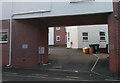
Coventry Watch Museum Project, site of plaque on Bedford Street
In the late 19th C. this was the site of the famous watchmaking firm of J.W. Player who made very high quality chronometers and watches.
It has now been redeveloped into blocks of modern flats.
The plaque is missing but probably stated:
Bedford Street - J.W. Player & Son's Watch & Chronometer Manufacturers
Image: © 360Libre
Taken: 19 Jan 2018
0.01 miles
2
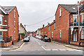
Brunswick Road
c.turn of the 19th/20th Centuries housing, first shown on the 1906 25 inch map.
Image: © Ian Capper
Taken: 25 Sep 2021
0.03 miles
3
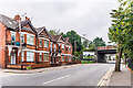
Albany Road
c.turn of the 19th/20th Centuries housing, first shown on the 1906 25 inch map. The bridge in the background carries the Coventry - Nuneaton railway.
Image: © Ian Capper
Taken: 25 Sep 2021
0.04 miles
4
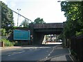
Albany Road, Earlsdon
Two railway bridges cross Albany Road. This one carries the Coventry-Nuneaton line.
Image: © E Gammie
Taken: 4 Jun 2021
0.05 miles
5
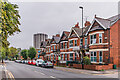
Albany Road
c.turn of the 19th/20th Centuries housing, first shown on the 1906 25 inch map. In the background is the Ramada Hotel, previously Telecom House.
Image: © Ian Capper
Taken: 25 Sep 2021
0.05 miles
6
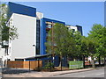
Earlsdon Park Village
The complex of retirement apartments in Albany Road, nearing completion.
Image: © E Gammie
Taken: 12 May 2016
0.07 miles
7
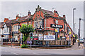
The New Albany
Pub on the corner of Albany Road and Broomfield Road, built in 1907. Originally The Albany, it was renamed The New Albany in 2018 following a reopening in 2018 having closed the previous year. Locally listed.
Image: © Ian Capper
Taken: 25 Sep 2021
0.08 miles
8
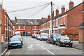
Brunswick Road
c.turn of the 19th/20th Centuries housing, first shown on the 1906 25 inch map.
Image: © Ian Capper
Taken: 25 Sep 2021
0.08 miles
9
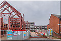
Albany Road student accommodation
A large student accommodation development in Albany Road, due to open in 2022. The site was previously the Spencer Sports and Social Club and prior to that an area of allotment gardens.
Image: © Ian Capper
Taken: 25 Sep 2021
0.08 miles
10
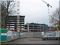
Earlsdon Park Village takes shape
Construction of the Earlsdon Park retirement complex on Albany Road is well under way and due to be opened in 2016 with 262 apartments built on land formerly occupied by the technical college tennis courts, bowling green and car park.
Image: © E Gammie
Taken: 25 Nov 2014
0.08 miles