
IMAGES TAKEN NEAR TO
West End, NUNEATON, CV13 0DG
Introduction
This page details the photographs taken nearby to West End, CV13 0DG by members of the Geograph project.
The Geograph project started in 2005 with the aim of publishing, organising and preserving representative images for every square kilometre of Great Britain, Ireland and the Isle of Man.

There are currently over 7.5m images from over14,400 individuals and you can help contribute to the project by visiting https://www.geograph.org.uk
Image Map
Images are licensed for reuse under creativecommons.org/licenses/by-sa/2.0
Notes
- Clicking on the map will re-center to the selected point.
- The higher the marker number, the further away the image location is from the centre of the postcode.
Image Listing (12 Images Found)
Images are licensed for reuse under creativecommons.org/licenses/by-sa/2.0
Image
Details
Distance
1
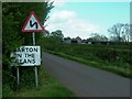
Barton in the Beans
What a wonderful name!
Image: © Andy and Hilary
Taken: 7 May 2005
0.08 miles
2
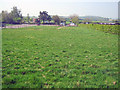
Paddocks at Barton in the Beans
Looking west to a pair of stable blocks with an exercise area on the left. Orange Hill in the background.
Image: © Trevor Rickard
Taken: 22 Apr 2011
0.10 miles
3
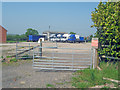
Yard at Barton in the Beans
Set back from Main Street is this yard with several lorries neatly parked. Nothing special except for the silly signs. The red one reads 'Private, no public right of way'. The white one reads 'Private, no public right of way, legal action may be taken against unauthorised persons found on this property'.
Image: © Trevor Rickard
Taken: 22 Apr 2011
0.19 miles
4
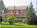
Side view of Barton Baptist Chapel
From the public footpath, looking at the east elevation.
Image: © Trevor Rickard
Taken: 22 Apr 2011
0.19 miles
5
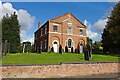
Barton In The Beans Baptist Chapel
On Main Street.
Image: © Ian Rob
Taken: 4 Oct 2021
0.19 miles
6
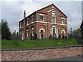
Barton in the Beans: Baptist chapel
Rebuilt in 1841 according to the plaque in the gable, this chapel is on the main street in this most bizarrely named village.
Image: © Chris Downer
Taken: 18 Apr 2008
0.19 miles
7
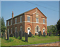
Barton Baptist Chapel
Quite a striking building on Main Street, built in 1841. Leicestershire was once noted for cultivating broad beans and this is one village where the name has been perpetuated.
Image: © Trevor Rickard
Taken: 22 Apr 2011
0.19 miles
8
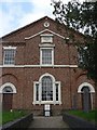
Barton in the Beans: Baptist chapel detail
Looking along the pathway to the Image; the village war memorial is in the centre of the picture, naming Messrs. Thompson and Maiden from the First World War and Messrs. Groves and Stevens from the Second.
Image: © Chris Downer
Taken: 18 Apr 2008
0.20 miles
9
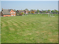
Playing field at Barton in the Beans
View north-east across a small playing field on the south side of Main Street, which runs behind the row of houses.
Image: © Trevor Rickard
Taken: 22 Apr 2011
0.20 miles
10
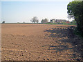
Potato field at Barton in the Beans
View north-east across a freshly planted field. Odstone Road housing on the right.
Image: © Trevor Rickard
Taken: 22 Apr 2011
0.21 miles