
IMAGES TAKEN NEAR TO
Kilderkin Court, COVENTRY, CV1 2UF
Introduction
This page details the photographs taken nearby to Kilderkin Court, CV1 2UF by members of the Geograph project.
The Geograph project started in 2005 with the aim of publishing, organising and preserving representative images for every square kilometre of Great Britain, Ireland and the Isle of Man.

There are currently over 7.5m images from over14,400 individuals and you can help contribute to the project by visiting https://www.geograph.org.uk
Image Map
Images are licensed for reuse under creativecommons.org/licenses/by-sa/2.0
Notes
- Clicking on the map will re-center to the selected point.
- The higher the marker number, the further away the image location is from the centre of the postcode.
Image Listing (95 Images Found)
Images are licensed for reuse under creativecommons.org/licenses/by-sa/2.0
Image
Details
Distance
1
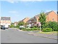
Furlong Road
This road may well be 220 yards long although it's a bit difficult to tell where it ends. It stands at the approximate location of the private Puma Road, which ran east-west across the old Armstrong-Siddeley factory site. A new road, Puma Way is a little further north. The roads in this housing development follow a weights and measures theme and the namer-of-roads has come up with the combination name of Perchfoot Close on the right. One perch, rod or pole = 5.5 yards. 1 foot = 12 inches.
Image: © E Gammie
Taken: 25 Jun 2010
0.03 miles
2
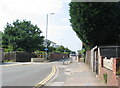
Mile Lane bridge
The traffic-light controlled single lane bridge over the London Euston-Coventry rail line.
The bridge is more interesting than it might appear. In December 2015 it was listed by English Heritage as grade II as it dates from c. 1838, the early period of railway development, and may be the first example of a flying arch bridge over a railway in the country.
Image: © E Gammie
Taken: 25 Jun 2010
0.05 miles
3
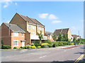
Mile Lane
A comparatively new housing development on the Burlington Works site of the old Armstrong-Siddeley factory. The varied designs and roof-lines break the monotony often associated with such developments. Furlong Road, to the left, continues an Imperial measures theme.
Image: © E Gammie
Taken: 25 Jun 2010
0.06 miles
4
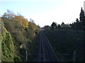
Railway towards Rugby
From the bridge on Mile Lane.
Image: © JThomas
Taken: 19 Nov 2016
0.07 miles
5
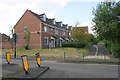
Peckstone Close houses off Quarryfield Lane
Ordnance Survey records indicate that in 1959 a benchmark levelled at 94.287m above Newlyn Datum was verified at this location on Burlington Works (motor carriage)
Image: © Roger Templeman
Taken: 31 Aug 2017
0.10 miles
6
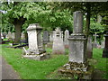
Memorials, London Road Cemetery, Coventry
One of the earliest municipal cemeteries in Britain, it saw its first interment in December 1847.
It has a rich variety of memorials of all periods. Immediately left of the broken column (a popular Victorian form, which can be an allusion to freemasonry) is an unusual obeliskal headstone of polished grey granite.
The paths are bordered by Silver Pendent Limes (Tilia petiolaris DC), left, whose branches have been trained into a candelabra form.
Image: © Robin Stott
Taken: 8 May 2009
0.10 miles
7

Mile Lane
A building on the former factory site at Parkside.
Image: © E Gammie
Taken: 25 Jun 2010
0.10 miles
8
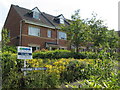
Peckstone Close
The east side of a housing development built on the site of the Burlington Works of Armstrong Siddeley. The road names follow a weights and measures theme, in this case a combination name. 1 peck = 2 gallons. 1 stone = 14 lbs.
Image: © E Gammie
Taken: 25 Jun 2010
0.11 miles
9
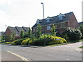
Quarryfield Lane
The eastern side of the housing development between Mile Lane and Quarryfield Lane with the corner of Bushelton Close, another combination of measures, in the foreground. 1 bushel = 4 pecks. 1 ton = 160 stone.
Image: © E Gammie
Taken: 25 Jun 2010
0.11 miles
10
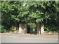
London Road cemetery, Quarryfield Lane gate, Coventry CV1
Image: © Robin Stott
Taken: 9 Aug 2012
0.12 miles