
IMAGES TAKEN NEAR TO
Mile Lane, COVENTRY, CV1 2TU
Introduction
This page details the photographs taken nearby to Mile Lane, CV1 2TU by members of the Geograph project.
The Geograph project started in 2005 with the aim of publishing, organising and preserving representative images for every square kilometre of Great Britain, Ireland and the Isle of Man.

There are currently over 7.5m images from over14,400 individuals and you can help contribute to the project by visiting https://www.geograph.org.uk
Image Map
Images are licensed for reuse under creativecommons.org/licenses/by-sa/2.0
Notes
- Clicking on the map will re-center to the selected point.
- The higher the marker number, the further away the image location is from the centre of the postcode.
Image Listing (117 Images Found)
Images are licensed for reuse under creativecommons.org/licenses/by-sa/2.0
Image
Details
Distance
1
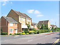
Mile Lane
A comparatively new housing development on the Burlington Works site of the old Armstrong-Siddeley factory. The varied designs and roof-lines break the monotony often associated with such developments. Furlong Road, to the left, continues an Imperial measures theme.
Image: © E Gammie
Taken: 25 Jun 2010
0.05 miles
2
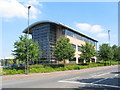
Mile Lane
A building on the former factory site at Parkside.
Image: © E Gammie
Taken: 25 Jun 2010
0.06 miles
3
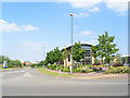
Puma Way, Mile Lane
A new road across the technology park. A reminder of the private Puma Road which stood a little south of here and crossed the Armstrong-Siddeley factory formerly on this site.
Image: © E Gammie
Taken: 25 Jun 2010
0.08 miles
4
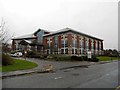
Coventry-Cheylesmore House North
Skills Funding Agency on Quinton Road.
Image: © Ian Rob
Taken: 10 Feb 2013
0.08 miles
5
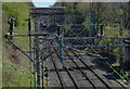
View east along the West Coast Main Line
Image: © Mat Fascione
Taken: 18 Apr 2015
0.09 miles
6
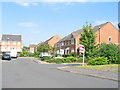
Furlong Road
This road may well be 220 yards long although it's a bit difficult to tell where it ends. It stands at the approximate location of the private Puma Road, which ran east-west across the old Armstrong-Siddeley factory site. A new road, Puma Way is a little further north. The roads in this housing development follow a weights and measures theme and the namer-of-roads has come up with the combination name of Perchfoot Close on the right. One perch, rod or pole = 5.5 yards. 1 foot = 12 inches.
Image: © E Gammie
Taken: 25 Jun 2010
0.09 miles
7
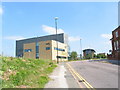
Mile Lane
Technology park buildings on the left. A corner of Elm Bank on the right.
As can be seen, the road is rising at this point and achieves a maximum elevation of 103 metres just beyond the curved roof building, making this one of the higher points close to the city centre and higher than the cathedral's site.
Image: © E Gammie
Taken: 25 Jun 2010
0.10 miles
8
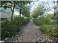
Early leaf fall, Coventry University Technology Park
Along a path parallel to Puma Way.
Image: © Christine Johnstone
Taken: 24 Sep 2021
0.10 miles
9
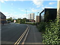
Mile Lane, Coventry
The western boundary of Coventry University technology Park.
Image: © Christine Johnstone
Taken: 24 Sep 2021
0.10 miles
10
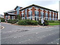
National Office of the Learning and Skills Council
The Learning and Skills Council of England funds further education. http://www.lsc.gov.uk
Image: © Roger Miller
Taken: 27 Sep 2005
0.11 miles