
IMAGES TAKEN NEAR TO
Cheylesmore, COVENTRY, CV1 2HL
Introduction
This page details the photographs taken nearby to Cheylesmore, CV1 2HL by members of the Geograph project.
The Geograph project started in 2005 with the aim of publishing, organising and preserving representative images for every square kilometre of Great Britain, Ireland and the Isle of Man.

There are currently over 7.5m images from over14,400 individuals and you can help contribute to the project by visiting https://www.geograph.org.uk
Image Map
Images are licensed for reuse under creativecommons.org/licenses/by-sa/2.0
Notes
- Clicking on the map will re-center to the selected point.
- The higher the marker number, the further away the image location is from the centre of the postcode.
Image Listing (803 Images Found)
Images are licensed for reuse under creativecommons.org/licenses/by-sa/2.0
Image
Details
Distance
1
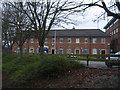
Cheylesmore, former Employment Exchange
From the days when UB40 was known as a name for the form given to unemployment benefit claimants, rather than a band.
Image: © E Gammie
Taken: 19 Dec 2015
0.01 miles
2
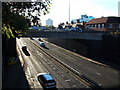
Ringway St. Patricks, Coventry
This dual carriageway was the last section of the ring road to be completed in the 1970's.
The angle of the sunlight highlights the poor condition of the road surface - roads in Coventry were very poorly maintained during the first few years of the 21st century and they are only just starting to be repaired.
Also note the recently installed crash barrier on the left of the photo - I understand that it is designed to crumple if a vehicle hits it.
The red brick building on the right is the employment exchange /job centre on the corner of St.Patrick's Road and Cheylesmore.
Image: © John Brightley
Taken: 25 Oct 2010
0.03 miles
3
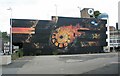
New Union Street car park
The striking mural on the side wall of the multi-storey car park is 'Atmosphere' by Nomad Clan and is one of the largest of several murals that appeared in and around Coventry as part of City of Culture 2021-2022 under the umbrella project 'In Paint we Trust'.
Image: © E Gammie
Taken: 21 Sep 2022
0.04 miles
4
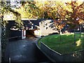
Pedestrian subway near New Union Street, Coventry
This footpath leads through the centre of the New Union St / Ringway St Patricks roundabout, past the Martyrs Memorial in the centre of the roundabout, down steps and through the subway seen here out on to New Union Street. Considering it is actually the centre of a roundabout, this area is surprisingly leafy and green.
Image: © John Brightley
Taken: 25 Oct 2010
0.04 miles
5
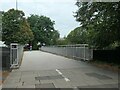
Footbridge over the Ringway, Coventry
The suffragette ribbons on the railings have labels reading 'Trans women are women' and 'Working women are women'.
Image: © Christine Johnstone
Taken: 24 Sep 2021
0.04 miles
6

City Centre from Manor Road footbridge, Coventry
In the foreground is the ring road, and behind that the few surviving original houses of St Patrick's Road. When this section of the ring road was built in the early 1970's, it was the last part of the ring road to be completed, and involved the demolition of properties on the southern side of St Patrick's Road. At that time there were more properties on the northern side remaining, but some have since been demolished to make way for the open development site in the left foreground. This has had planning permission for a tall block of flats for a number of years, but work still has to start.
Image: © John Brightley
Taken: 6 Jan 2015
0.04 miles
8
![Ringway [A4053], Coventry](https://s2.geograph.org.uk/geophotos/06/97/48/6974878_42a9e239_120x120.jpg)
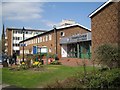
Ringway [A4053], Coventry
The inner ring road completely surrounds Coventry city centre - a bracelet of junctions, bridges and underpasses. This is the view from a pedestrian overbridge Image
Image: © Christine Johnstone
Taken: 24 Sep 2021
0.04 miles
9
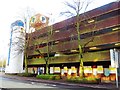
Multi-storey car park, New Union Street, Coventry
This car park was built in the early 1970's and was a slightly more refined version of the type commonly used at the time - note the distinctive elliptical stair tower, bold graphics, brick cladding, and offices on the ground floor which were originally the home of the city's Traffic Control Centre. I understand the latter has now moved to another council building.
Image: © John Brightley
Taken: 6 Jan 2015
0.05 miles
10
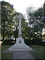
Coventry Martyrs memorial
This monument stands as a memorial to the eleven men and women who were put to death near this spot in the sixteenth century for their consciences. It is a granite and metal structure, created by G. Maile and sons in 1910; somewhat awkwardly, it is situated in the middle of the main ring road roundabout at St Patrick's. See Image] for their names.
Image: © Neil Owen
Taken: 24 Sep 2021
0.05 miles