1
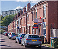
David Road
Early 20th Century street linking Charterhouse Road and St Margaret Road, connecting the end of Carmelite Road and Monks Road, the houses seen here.
Image: © Ian Capper
Taken: 24 Sep 2021
0.04 miles
2
Northfield Road
Early 20th Century housing, first appearing on the 1914 25 inch map.
Image: © Ian Capper
Taken: 24 Sep 2021
0.07 miles
3
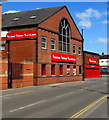
Gulson Lodge
Small retail/apartment block on Gulson Road built in the late 2010s.
Image: © Ian Capper
Taken: 24 Sep 2021
0.07 miles
4
Former Corner Shop, Charterhouse Road
Slightly more obvious than its companion across the road.
This is just one of many shops no longer in existence in this square.
Image: © Anthony Vosper
Taken: 16 Feb 2012
0.08 miles
5
Former Corner Shop, Charterhouse Road
The extended pebble dash is the only clue that this was once a shop.
Image: © Anthony Vosper
Taken: 16 Feb 2012
0.09 miles
6
Gulson Road
Early 20th Century housing in Gulson Road, first shown on the 1914 25 inch map. The shop on the corner is the former Hare and Hounds pub which moved here around 1906 from a previous site on Far Gosford Road. The original building here was destroyed by a bomb in 1940, and was replaced by the present building after the war. It closed in 2006, with use changing to a corner shop.
Image: © Ian Capper
Taken: 24 Sep 2021
0.09 miles
7
Buildbase Hirebase Electricbase in Coventry
Viewed across Gulson Road.
Image: © Jaggery
Taken: 18 Apr 2015
0.10 miles
8
Exit from Fargo Village onto Grafton Street, Coventry
Or the entrance from Grafton Street, if you are coming that way to Fargo Village, a bohemian business centre on Far Gosford Street, from which it takes its name. The premises on the right area PopBangColour, the studio of an artist, Ian Cook, who paints using radio-controlled model cars. https://www.popbangcolour.com/about-1
Image: © A J Paxton
Taken: 24 Jul 2021
0.11 miles
9
Irving Road
Early 20th Century housing, first appearing on the 1914 25 inch map. In the background is Paradise Student Village built in the late 2010s.
Image: © Ian Capper
Taken: 24 Sep 2021
0.12 miles
10
MGTS building, bridge of river, and tyre garage, Gulson Road
MGTS is Midland Group Training Services, the bridge is over River Sherbourne and the garage is Mr Tyre Ltd. There is an Ordnance Survey benchmark
Image overpainted white at the right hand end of the bridge parapet
Image: © Roger Templeman
Taken: 8 Aug 2017
0.12 miles


