
IMAGES TAKEN NEAR TO
Northfield Road, COVENTRY, CV1 2BP
Introduction
This page details the photographs taken nearby to Northfield Road, CV1 2BP by members of the Geograph project.
The Geograph project started in 2005 with the aim of publishing, organising and preserving representative images for every square kilometre of Great Britain, Ireland and the Isle of Man.

There are currently over 7.5m images from over14,400 individuals and you can help contribute to the project by visiting https://www.geograph.org.uk
Image Map
Images are licensed for reuse under creativecommons.org/licenses/by-sa/2.0
Notes
- Clicking on the map will re-center to the selected point.
- The higher the marker number, the further away the image location is from the centre of the postcode.
Image Listing (96 Images Found)
Images are licensed for reuse under creativecommons.org/licenses/by-sa/2.0
Image
Details
Distance
1
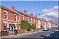
Northfield Road
Early 20th Century housing, first appearing on the 1914 25 inch map.
Image: © Ian Capper
Taken: 24 Sep 2021
0.02 miles
2
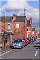
David Road
Early 20th Century street linking Charterhouse Road and St Margaret Road, connecting the end of Carmelite Road and Monks Road, the houses seen here.
Image: © Ian Capper
Taken: 24 Sep 2021
0.06 miles
3
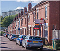
Irving Road
Early 20th Century housing, first appearing on the 1914 25 inch map. In the background is Paradise Student Village built in the late 2010s.
Image: © Ian Capper
Taken: 24 Sep 2021
0.07 miles
4
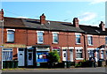
General Store, Northfield Rd
This must be one of the very few stores left that is still located on its own in a row of small terraced houses. The shop is directly opposite St Margaret's Rd. It would appear that the house next door has been converted from a shop back to a house.
Image: © Nigel Mykura
Taken: 11 Jun 2011
0.07 miles
5
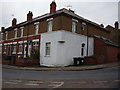
Former Corner Shop, Charterhouse Road
Slightly more obvious than its companion across the road.
This is just one of many shops no longer in existence in this square.
Image: © Anthony Vosper
Taken: 16 Feb 2012
0.07 miles
6
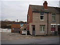
Former Corner Shop, Charterhouse Road
The extended pebble dash is the only clue that this was once a shop.
Image: © Anthony Vosper
Taken: 16 Feb 2012
0.09 miles
7
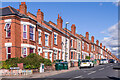
Humber Avenue
Early 20th Century housing, first appearing on the 1914 25 inch map.
Image: © Ian Capper
Taken: 24 Sep 2021
0.10 miles
8
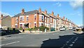
Junction of Humber Avenue and Terry Road
The north-east corner of the crossroads. The houses were built between 1903 and 1912.
Image: © Christine Johnstone
Taken: 24 Sep 2021
0.10 miles
10
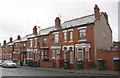
Houses on north side of Humber Avenue
Ordnance Survey documents indicate that in 1959 a benchmark levelled at 81.577m above Newlyn Datum was verified on the wall junction to the right of the right hand house (#140). The wall is the boundary wall of #138.
Image: © Luke Shaw
Taken: 8 Aug 2017
0.11 miles