
IMAGES TAKEN NEAR TO
Church Street, BEDWORTH, CV12 9NL
Introduction
This page details the photographs taken nearby to Church Street, CV12 9NL by members of the Geograph project.
The Geograph project started in 2005 with the aim of publishing, organising and preserving representative images for every square kilometre of Great Britain, Ireland and the Isle of Man.

There are currently over 7.5m images from over14,400 individuals and you can help contribute to the project by visiting https://www.geograph.org.uk
Image Map
Images are licensed for reuse under creativecommons.org/licenses/by-sa/2.0
Notes
- Clicking on the map will re-center to the selected point.
- The higher the marker number, the further away the image location is from the centre of the postcode.
Image Listing (23 Images Found)
Images are licensed for reuse under creativecommons.org/licenses/by-sa/2.0
Image
Details
Distance
1
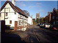
Church Street, Bulkington
Church Street, Bulkington, facing north. Showing the historic 3 and 4 Church Street (early 17th century) on the left, and St James' Church.
Image: © Peter Mackenzie
Taken: 9 Jan 2009
0.01 miles
2
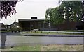
Bulkington Clinic, Chequer Street, 1975
The clinic was built in the 1960's and I think was replaced by the current building in the 1990's. It was needed as the village expanded greatly in the post-war years. The site in the foreground was vacant at the time the photo was taken - it had been the site of the Crown public house which was demolished in the late 1960's but was not built on again until the late 1980's when builder Mick Burris constructed the houses which now occupy the spot.
Image: © John Brightley
Taken: Unknown
0.05 miles
3
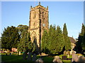
Bulkington - St James Church
Close to Playing Fields.
Image: © Ian Rob
Taken: 14 Sep 2005
0.06 miles
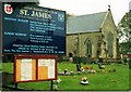
5
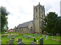
Bulkington, St. James'
Parish church on School Road, dating from the C13. Listed by English Heritage (Grade II*): http://www.imagesofengland.org.uk/Details/Default.aspx?id=308607&mode=quick
Image: © Mike Faherty
Taken: 8 Jun 2014
0.07 miles
6
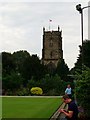
Tower, St. James', Bulkington
The gentlemen in front are playing bowls.
Image: © nick macneill
Taken: 28 Sep 2013
0.07 miles
8
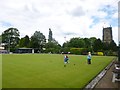
Bulkington, bowling green
At Bulkington Recreation Ground, which has sports pitches, tennis, club and play area as well as bowls. Image to the right.
Image: © Mike Faherty
Taken: 8 Jun 2014
0.08 miles
9
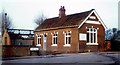
The Library, School Road, Bulkington, 1975
I apologise for the quality of this photograph, but it was one of my first photos, and it was taken on a Polaroid camera. I just managed to capture the demolition of the old Bulkington library before it was reduced to a pile of bricks. The moulded lettering on the gable end informs us that it was built as council offices in 1908. The entrance to the building was through the blue door that you see in the centre of the building. This led to a small lobby, from which the library was in the room to the right, lit by the 3 large windows. I remember it being a very cold building, heated only by a large cast iron stove. This building was demolished, along with the cottage next door to the right, to make way for the present library on the same site.
Image: © John Brightley
Taken: Unknown
0.08 miles
10
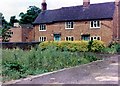
Home Farm, School Road, Bulkington, 1975
At this date the farmhouse looked very much as it must have done 100 years previously. It stood on the opposite side of the driveway which also gave access to the library seen in ImageI remember the land in the foreground of the photo being used as an allotment plot. In approximately 1980 this land in the foreground was used as the site for a new office building, and the old farmhouse was demolished in 1981.
Image: © John Brightley
Taken: Unknown
0.08 miles