Home Farm, School Road, Bulkington, 1975
Introduction
The photograph on this page of Home Farm, School Road, Bulkington, 1975 by John Brightley as part of the Geograph project.
The Geograph project started in 2005 with the aim of publishing, organising and preserving representative images for every square kilometre of Great Britain, Ireland and the Isle of Man.

There are currently over 7.5m images from over 14,400 individuals and you can help contribute to the project by visiting https://www.geograph.org.uk
Home Farm, School Road, Bulkington, 1975
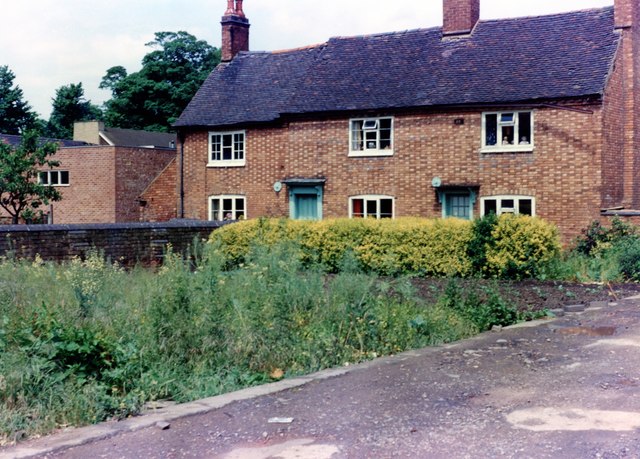
Image: © John Brightley Taken: Unknown
At this date the farmhouse looked very much as it must have done 100 years previously. It stood on the opposite side of the driveway which also gave access to the library seen in ImageI remember the land in the foreground of the photo being used as an allotment plot. In approximately 1980 this land in the foreground was used as the site for a new office building, and the old farmhouse was demolished in 1981.
Images are licensed for reuse under creativecommons.org/licenses/by-sa/2.0
Image Location


Leaflet Map data © OpenStreetMap
Latitude
52.476918
Longitude
-1.424282