
IMAGES TAKEN NEAR TO
Drayton Road, BEDWORTH, CV12 9EY
Introduction
This page details the photographs taken nearby to Drayton Road, CV12 9EY by members of the Geograph project.
The Geograph project started in 2005 with the aim of publishing, organising and preserving representative images for every square kilometre of Great Britain, Ireland and the Isle of Man.

There are currently over 7.5m images from over14,400 individuals and you can help contribute to the project by visiting https://www.geograph.org.uk
Image Map
Images are licensed for reuse under creativecommons.org/licenses/by-sa/2.0
Notes
- Clicking on the map will re-center to the selected point.
- The higher the marker number, the further away the image location is from the centre of the postcode.
Image Listing (13 Images Found)
Images are licensed for reuse under creativecommons.org/licenses/by-sa/2.0
Image
Details
Distance
1
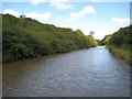
Coventry Canal: Bedworth Hill Cutting
A vast amount of soil and rock must have been excavated in the 1780s to create this straight cutting through Bedworth Hill. Both banks have been colonized by dense impenetrable thorn scrub making it a most inhospitable place. Centenary Way, celebrating 100 years of Warwickshire County Council, follows the towpath on the right here.
Image: © Nigel Cox
Taken: 11 Sep 2012
0.07 miles
2
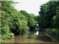
The Coventry Canal, Bedworth, Warwickshire
The Act of Parliament enabling the construction of the Coventry Canal was passed in 1768, and construction as far as Atherstone by 1771 was followed by the company running out of money and the sacking of James Brindley. One of the purposes of the canal was to provide Coventry with a regular supply of cheap coal from the Bedworth coalfield, which it already did by 1769.
The towpath here is used as part of The Centenary Way, a long distance walking path covering about 100 miles in Warwickshire.
Image: © Roger D Kidd
Taken: 10 Jun 2008
0.09 miles
3
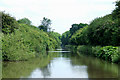
The Coventry Canal, Bedworth, Warwickshire
The Act of Parliament enabling the construction of the Coventry Canal was passed in 1768, and construction as far as Atherstone by 1771 was followed by the company running out of money and the sacking of James Brindley. One of the purposes of the canal was to provide Coventry with a regular supply of cheap coal from the Bedworth coalfield, which it already did by 1769.
The towpath here is used as part of The Centenary Way, a long distance walking path covering about 100 miles in Warwickshire.
Image: © Roger D Kidd
Taken: 10 Jun 2008
0.17 miles
5
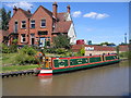
The Navigation
A narrowboat on the Coventry Canal moored up by the garden of the Navigation by Bulkington Bridge.
Image: © David Stowell
Taken: 14 Jul 2006
0.21 miles
6
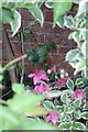
Benchmark on #115 Bulkington Road
Ordnance Survey cut mark benchmark described on the Bench Mark Database at http://www.bench-marks.org.uk/bm66860
Image: © Roger Templeman
Taken: 19 May 2015
0.21 miles
7
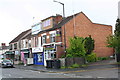
Row of shops on Bulkington Road
There is an OS benchmark Image on the side of the near shop ('Masalla House') near its front corner, behind plants behind the wooden fence.
Image: © Roger Templeman
Taken: 19 May 2015
0.21 miles
8
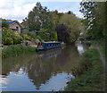
Coventry Canal on the edge of Bedworth
The houses on the left are at Columbia Gardens.
Image: © Mat Fascione
Taken: 28 Sep 2014
0.21 miles
9
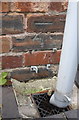
Benchmark on #173 Bulkington Road
Ordnance Survey cut mark benchmark described on the Bench Mark Database at http://www.bench-marks.org.uk/bm66859
Image: © Roger Templeman
Taken: 19 May 2015
0.23 miles
10
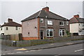
Junction of Bulkington Road and West Avenue
There is an OS benchmark Image on the side of the near house by the grey downpipe
Image: © Roger Templeman
Taken: 19 May 2015
0.23 miles