
IMAGES TAKEN NEAR TO
Regent Street, BEDWORTH, CV12 9BN
Introduction
This page details the photographs taken nearby to Regent Street, CV12 9BN by members of the Geograph project.
The Geograph project started in 2005 with the aim of publishing, organising and preserving representative images for every square kilometre of Great Britain, Ireland and the Isle of Man.

There are currently over 7.5m images from over14,400 individuals and you can help contribute to the project by visiting https://www.geograph.org.uk
Image Map
Images are licensed for reuse under creativecommons.org/licenses/by-sa/2.0
Notes
- Clicking on the map will re-center to the selected point.
- The higher the marker number, the further away the image location is from the centre of the postcode.
Image Listing (18 Images Found)
Images are licensed for reuse under creativecommons.org/licenses/by-sa/2.0
Image
Details
Distance
2
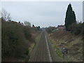
Railway towards Bedworth and Coventry
Looking south from the bridge on Marston Lane.
Image: © JThomas
Taken: 11 Mar 2017
0.15 miles
3
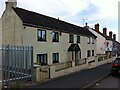
Vernacular houses, Marston Lane, Bedworth
Easily missed, these cottages are a rare survivor of old Marston Lane, otherwise mostly built up with late Victorian terraced houses and 20th century council housing. The cottages appear to have been restored in the 1980s, and whoever did it was commended by the Bedworth Society, whose grey roundel can be seen on the front.
Image: © A J Paxton
Taken: 5 Jun 2021
0.19 miles
4
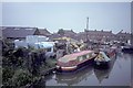
Gilbert Brothers' Charity Dock at Bedworth
Image: © Andrew Longton
Taken: 5 Jun 1985
0.20 miles
5
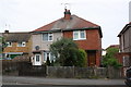
Semi-detached houses on Johnson Road
There is an OS benchmark Image on the side of the right hand house near its front corner
Image: © Roger Templeman
Taken: 22 May 2015
0.20 miles
6
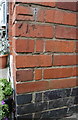
Benchmark on #33 Johnson Road
Ordnance Survey cut mark benchmark described on the Bench Mark Database at http://www.bench-marks.org.uk/bm67125
Image: © Roger Templeman
Taken: 22 May 2015
0.20 miles
7
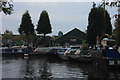
Charity Dock, near Bedworth
The Coventry canal. A boat repair yard is here and there are several boats moored nearby in varying states of dilapidation.
Image: © Robert Eva
Taken: 25 Oct 2016
0.21 miles
8
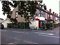
Off Licence, corner of Knightsbridge Avenue & Marston Lane
Booze Zone of Marston Lane, Bedworth, is doing a busy sideline in potted plants, which are being watered on a warm June evening.
Image: © A J Paxton
Taken: 5 Jun 2021
0.21 miles
9
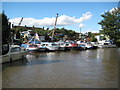
Coventry Canal: Charity Dock
This boatyard is rather like the inside of my garage but on a gargantuan scale. By all accounts the operators pride themselves in the jumble of boats and bits stacked high into the sky. Very sadly though I am reminded of the images of harbours after the March 2011 Japanese tsunami.
The dock does however have an interesting history. A local and early Bedworth charity bought farmland around the town, and when coal was found and collieries built to extract it the charities became very rich. One such mine nearby was consequently known as the Bedworth Charity Colliery. The nearest point on the canal to the colliery was at the corner here, and a wharf was therefore built with a tramway connection to the colliery in order to transport coal for shipping on narrowboats. Each narrowboat could transport up to 30 tons of coal. The wharf therefore became known as Charity Wharf or Dock. The colliery ceased production in 1924 and the tramway was lifted, so the dock remains as a surviving artefact of Bedworth's former coal mining history.
Image: © Nigel Cox
Taken: 11 Sep 2012
0.22 miles
10
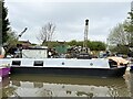
Charity Dock
A boat storage facility on the Coventry Canal.
Image: © Andrew Abbott
Taken: 2 May 2023
0.22 miles