Coventry Canal: Charity Dock
Introduction
The photograph on this page of Coventry Canal: Charity Dock by Nigel Cox as part of the Geograph project.
The Geograph project started in 2005 with the aim of publishing, organising and preserving representative images for every square kilometre of Great Britain, Ireland and the Isle of Man.

There are currently over 7.5m images from over 14,400 individuals and you can help contribute to the project by visiting https://www.geograph.org.uk
Coventry Canal: Charity Dock
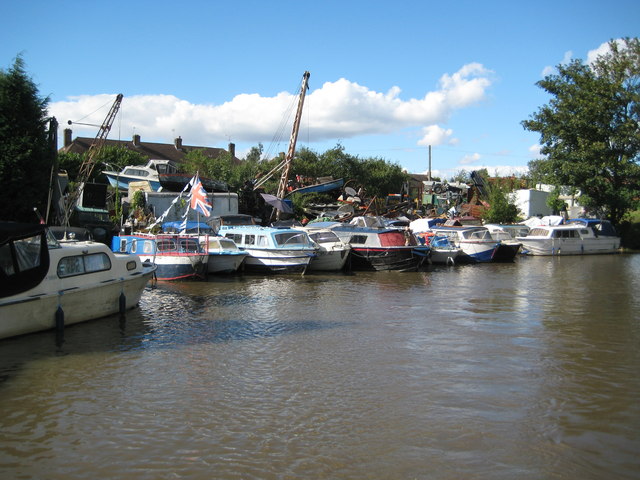
Image: © Nigel Cox Taken: 11 Sep 2012
This boatyard is rather like the inside of my garage but on a gargantuan scale. By all accounts the operators pride themselves in the jumble of boats and bits stacked high into the sky. Very sadly though I am reminded of the images of harbours after the March 2011 Japanese tsunami. The dock does however have an interesting history. A local and early Bedworth charity bought farmland around the town, and when coal was found and collieries built to extract it the charities became very rich. One such mine nearby was consequently known as the Bedworth Charity Colliery. The nearest point on the canal to the colliery was at the corner here, and a wharf was therefore built with a tramway connection to the colliery in order to transport coal for shipping on narrowboats. Each narrowboat could transport up to 30 tons of coal. The wharf therefore became known as Charity Wharf or Dock. The colliery ceased production in 1924 and the tramway was lifted, so the dock remains as a surviving artefact of Bedworth's former coal mining history.
Images are licensed for reuse under creativecommons.org/licenses/by-sa/2.0
Image Location
Latitude
52.48518
Longitude
-1.460547