
IMAGES TAKEN NEAR TO
Delamere Road, BEDWORTH, CV12 8SG
Introduction
This page details the photographs taken nearby to Delamere Road, CV12 8SG by members of the Geograph project.
The Geograph project started in 2005 with the aim of publishing, organising and preserving representative images for every square kilometre of Great Britain, Ireland and the Isle of Man.

There are currently over 7.5m images from over14,400 individuals and you can help contribute to the project by visiting https://www.geograph.org.uk
Image Map
Images are licensed for reuse under creativecommons.org/licenses/by-sa/2.0
Notes
- Clicking on the map will re-center to the selected point.
- The higher the marker number, the further away the image location is from the centre of the postcode.
Image Listing (7 Images Found)
Images are licensed for reuse under creativecommons.org/licenses/by-sa/2.0
Image
Details
Distance
1
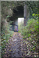
Footpath bridge under the A444
This seems a very substantial bridge to carry the Bedworth by-pass over a footpath. In fact when the road was built in the 1970s there was a railway here - the Newdigate Colliery Railway. The colliery was closed in 1982 and the railway would have done so, probably shortly afterwards, when all remaining coal stocks had been removed.
Image: © Stephen McKay
Taken: 18 Nov 2022
0.11 miles
3
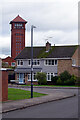
Gallagher Road and Bedworth Water Tower
Bedworth's water tower, built in 1898 and now converted into luxury apartments, overlooks an otherwise bland suburban scene.
Image: © Stephen McKay
Taken: 18 Nov 2022
0.21 miles
5
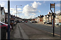
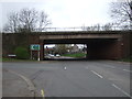
West on Newtown Road, Bedworth
It's bridged by the A444 dual carriageway in SP3486, left of centre. The space between the houses, half right, is the entrance to Bedworth Sloughs, a lake thought to be the result of mining subsidence, fed by the young River Sowe.
Image: © Robin Stott
Taken: 31 Jan 2018
0.23 miles
6
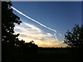
The contrails are back
A sign of the resumption of air travel as the Covid-19 pandemic recedes. A band of cirrus-like cloud forms a travel corridor across an otherwise clear sky. Photo taken at sunset from the waste ground at Hawkesbury; the Bedworth water tower can be seen on the horizon.
Image: © A J Paxton
Taken: 30 May 2021
0.24 miles
7
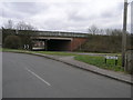
High Level A444
The A444 dual carriageway cuts through Bedworth on a high embankment.
Image: © Michael Patterson
Taken: 21 Mar 2006
0.24 miles