
IMAGES TAKEN NEAR TO
Ambleside Road, BEDWORTH, CV12 8RS
Introduction
This page details the photographs taken nearby to Ambleside Road, CV12 8RS by members of the Geograph project.
The Geograph project started in 2005 with the aim of publishing, organising and preserving representative images for every square kilometre of Great Britain, Ireland and the Isle of Man.

There are currently over 7.5m images from over14,400 individuals and you can help contribute to the project by visiting https://www.geograph.org.uk
Image Map
Images are licensed for reuse under creativecommons.org/licenses/by-sa/2.0
Notes
- Clicking on the map will re-center to the selected point.
- The higher the marker number, the further away the image location is from the centre of the postcode.
Image Listing (12 Images Found)
Images are licensed for reuse under creativecommons.org/licenses/by-sa/2.0
Image
Details
Distance
1
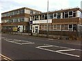
Toye, Kenning & Spencer, Newtown Road, Bedworth
This plain commercial building is home to a rare survivor of the Coventry and Bedworth ribbon weaving industry, which largely collapsed in the 1860s. Whereas Cash's in Coventry survived by specialising in woven name tapes, Toye, Kenning & Spencer make coloured ribbons, braids and laces, for products such as military medals and uniforms and masonic regalia; the company holds a royal warrant for "Supply of Gold and Silver Laces, Insignia and Embroidery", hence the royal coat of arms displayed on the building. Metalwork is made in the Jewellery Quarter in Birmingham, while the company has a shop in the west end of London.
In its present form, the company dates from 1962, but it has its origins in 1685, when the Toyé family, French Protestant refugees ('Huguenots'), arrived in London, where they set up in the textile business they had practised in France. The Toye family continues to play a part in the business, which is privately-owned. https://en.wikipedia.org/wiki/Toye,_Kenning_%26_Spencer
Image: © A J Paxton
Taken: 4 Aug 2021
0.07 miles
2
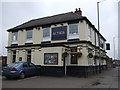
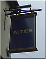
Alties public house, Bedworth
On Newtown Road.
Image: © JThomas
Taken: 11 Mar 2017
0.09 miles
4
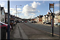
West on Newtown Road, Bedworth
It's bridged by the A444 dual carriageway in SP3486, left of centre. The space between the houses, half right, is the entrance to Bedworth Sloughs, a lake thought to be the result of mining subsidence, fed by the young River Sowe.
Image: © Robin Stott
Taken: 31 Jan 2018
0.18 miles
5
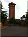
Bedworth water tower, viewed from Tower Road
Built in 1898, the 45 metre tower is a prominent and very distinctive Bedworth landmark. After some years of disuse it was sold in 2015 for conversion into flats and now appears to be part of a gated luxury housing enclave. https://historicengland.org.uk/listing/the-list/list-entry/1116416 https://www.coventrytelegraph.net/news/local-news/look-go-inside-bedworth-water-9528106
Image: © A J Paxton
Taken: 5 Jun 2021
0.20 miles
6
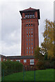
Bedworth Water Tower
Bedworth's 45m (148ft) tall water tower, built in a simplified Romanesque style, is a prominent local landmark. It is dated 1898 but was not actually completed until 1900 and is now grade II listed. The tower supplied the town with water fed by gravity from a tank at the top; the water was extracted from an 84m (275ft) deep bore hole. That alone, however, was not sufficient to supply all the town's needs and additional water was pumped out of the Newdigate Colliery workings at a depth of about 460m (1500ft) - the colliery water was actually considered to be better quality. Today Bedworth's water is supplied from Welsh reservoirs and the tower was sold in 2015 for conversion to luxury apartments.
Image: © Stephen McKay
Taken: 18 Nov 2022
0.21 miles
7
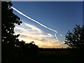
The contrails are back
A sign of the resumption of air travel as the Covid-19 pandemic recedes. A band of cirrus-like cloud forms a travel corridor across an otherwise clear sky. Photo taken at sunset from the waste ground at Hawkesbury; the Bedworth water tower can be seen on the horizon.
Image: © A J Paxton
Taken: 30 May 2021
0.21 miles
8
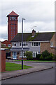
Gallagher Road and Bedworth Water Tower
Bedworth's water tower, built in 1898 and now converted into luxury apartments, overlooks an otherwise bland suburban scene.
Image: © Stephen McKay
Taken: 18 Nov 2022
0.22 miles
9
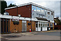
The Saunders, Bedworth
At first glance this could be taken for a pub, albeit one housed in a particularly unattractive box of a building. It is, in fact, a private club whose full name is the Saunders Hall Working Men's Club. It is situated on Saunders Avenue close to the town centre.
Image: © Stephen McKay
Taken: 18 Nov 2022
0.22 miles
10
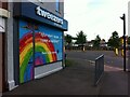
Coronavirus rainbow, Bedworth
Tweezers Beauty Bar at the corner of Mill Street and George Street Ringway, offering thanks to key workers on their shop shutters.
Image: © A J Paxton
Taken: 5 Jun 2021
0.24 miles