
IMAGES TAKEN NEAR TO
Newcomen Close, BEDWORTH, CV12 0ER
Introduction
This page details the photographs taken nearby to Newcomen Close, CV12 0ER by members of the Geograph project.
The Geograph project started in 2005 with the aim of publishing, organising and preserving representative images for every square kilometre of Great Britain, Ireland and the Isle of Man.

There are currently over 7.5m images from over14,400 individuals and you can help contribute to the project by visiting https://www.geograph.org.uk
Image Map
Images are licensed for reuse under creativecommons.org/licenses/by-sa/2.0
Notes
- Clicking on the map will re-center to the selected point.
- The higher the marker number, the further away the image location is from the centre of the postcode.
Image Listing (11 Images Found)
Images are licensed for reuse under creativecommons.org/licenses/by-sa/2.0
Image
Details
Distance
1
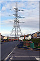
Newcomen Road, Bedworth Heath
It's astonishing how tall an electricity transmission tower appears to be when stood against an ordinary two-storey house. The tower seems to dominate this scene on the outskirts of Bedworth but the locals probably barely notice it.
Image: © Stephen McKay
Taken: 18 Nov 2022
0.09 miles
2
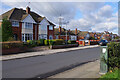
Dark Lane, Bedworth Heath
Dark Lane, seen here from close to the junction with Goodyers End Lane, has a mix of housing styles including the semi-detached house on the left which probably dates from the 1950s.
Image: © Stephen McKay
Taken: 18 Nov 2022
0.14 miles
3
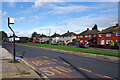
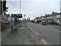
Dark Lane, Bedworth Heath
The bus stop here in an estate of mixed housing is served by one of several different routes that connect Coventry and Bedworth.
Image: © Stephen McKay
Taken: 18 Nov 2022
0.16 miles
4
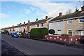
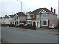
Keenan Drive, Bedworth Heath
Probably dating from around the early 1960s, these houses are typical of their era: very uniform and built in a dead straight line.
Image: © Stephen McKay
Taken: 18 Nov 2022
0.16 miles
6
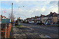
Goodyers End Lane, Bedworth Heath
Looking along Goodyers End Lane from close to the junction with Dark Lane. Despite the bus shelter and bus stop, regular buses do not now use this road.
Image: © Stephen McKay
Taken: 18 Nov 2022
0.19 miles
8
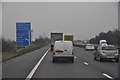
North Warwickshire : The M6 Motorway
The M6 motorway approaching junction 3 in Warwickshire.
Image: © Lewis Clarke
Taken: 6 Feb 2012
0.22 miles
9
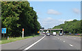
M6 north of Coventry
Royal Oak Lane bridge ahead.
At marker 156.5
Image: © J. Hannan-Briggs
Taken: 18 Jul 2015
0.23 miles
10
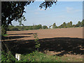
M6 across a field, Ash Green
This section of the motorway is between junctions 3 and 4. Some maps call this area Exhall, in CV7. Whatever, it's very noisy.
Image: © Robin Stott
Taken: 11 Oct 2010
0.24 miles